
EAS 372 exercise of Thurs 24 Jan 2013 -- a forecast for Tues 29 Jan
Today's exercise (10:20-10:50): on the basis of available progs (e.g. GEM-glbl and NCEP's GFS), give your weather forecast for central Alberta for the period 12Z Tues 29 - 12Z Wed 30 Jan. Jot down your qualitative prediction for the weather elements (i.e. temperature, sky condition, precip, wind speed); and compare the forecast 1000-500 thickness with the present value. Any major uncertainties should be acknowledged. (Please submit at end of class).
Available guidance
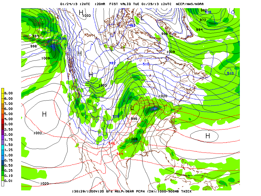
- GFS 120 hr fcst valid 12Z Tues 29 Jan. (surface/thk/prcp)
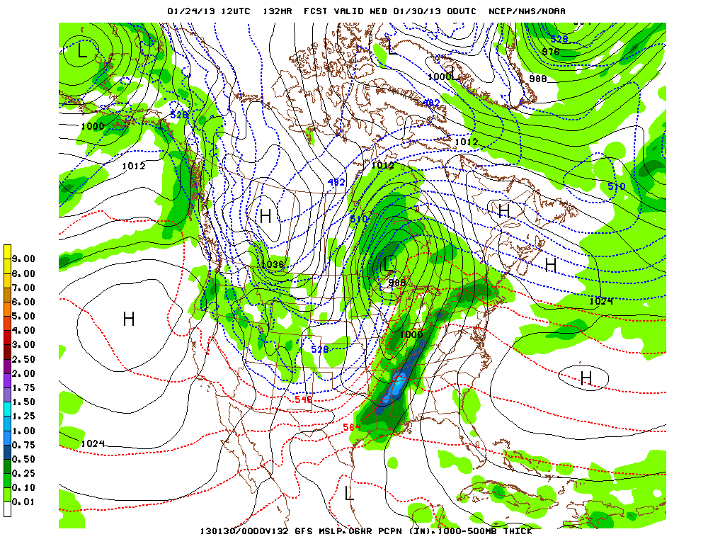
- GFS 132 hr fcst valid 00Z Wed 30 Jan. (surface/thk/prcp)
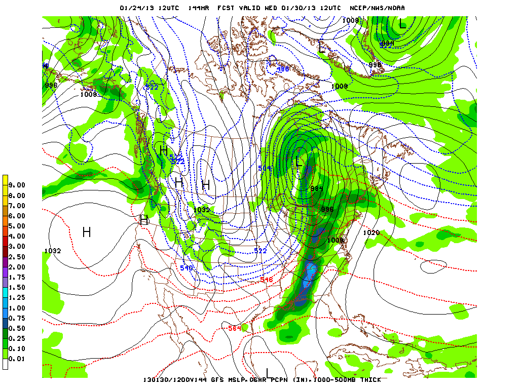
- GFS 144 hr fcst valid 12Z Wed 30 Jan. (surface/thk/prcp)
- GFS sees an arctic ridge, cold, trace of precip early in the period, ridge axis beginning to move east with thickness increasing again
-
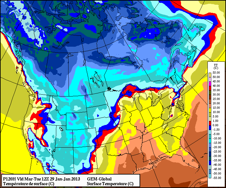
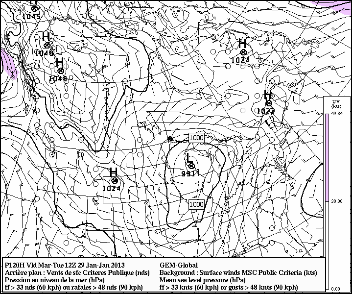
- GEM-glbl 120 hr fcst valid 12Z Tues 29 Jan. (surface/thk)
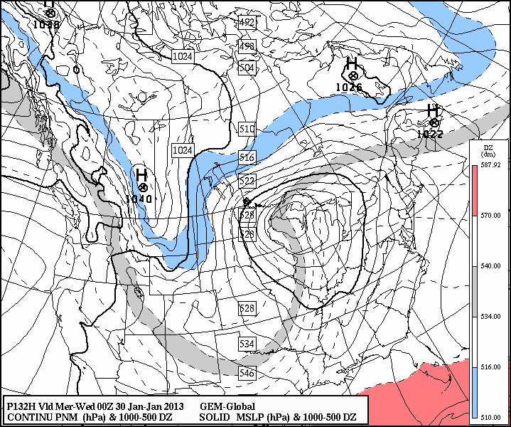
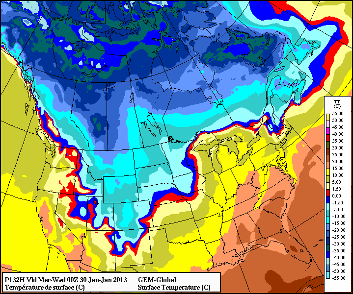
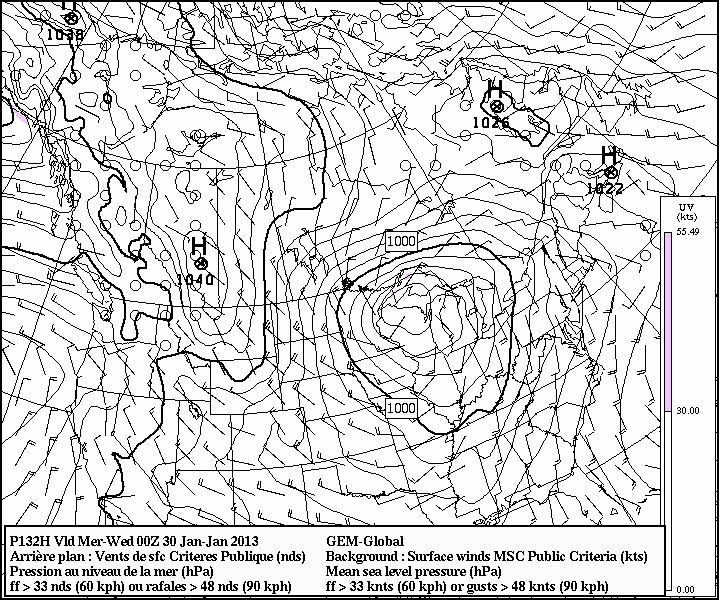
- GEM-glbl 132 hr fcst valid 00Z Wed 30 Jan. (surface/thk)
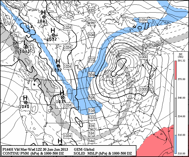
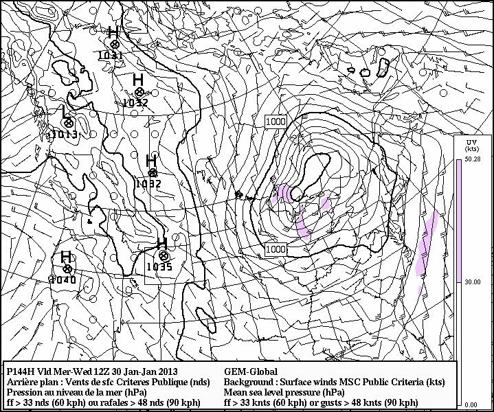
- GEM-glbl 144 hr fcst valid 12Z Wed 30 Jan. (surface/thk)
- GEM broadly consistent
-
- GEM-glbl 120 hr fcst valid 12Z Tues 29 Jan. (sfc temp)
- GEM-glbl 132 hr fcst valid 00Z Wed 30 Jan. (sfc temp)
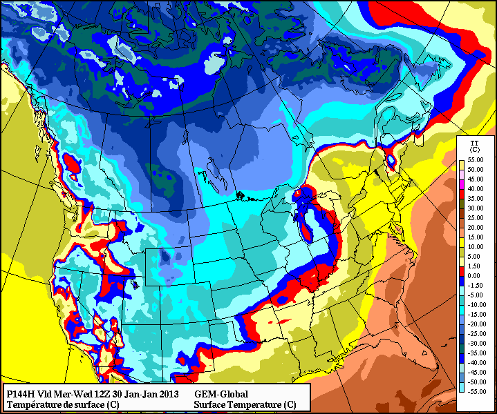
- GEM-glbl 144 hr fcst valid 12Z Wed 30 Jan. (sfc temp)
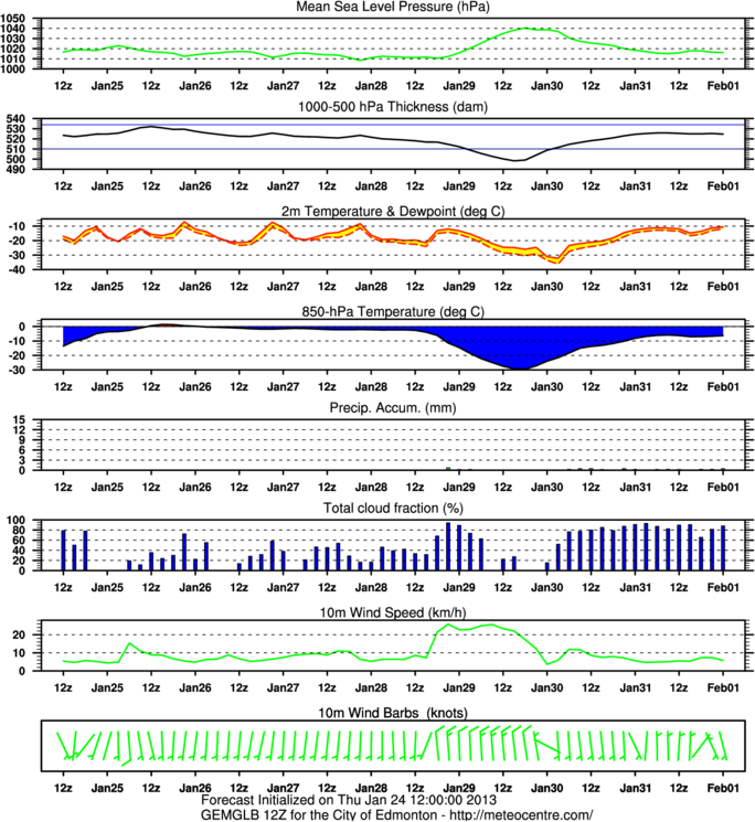
- GEM has us in the -20 to -25 range of surface temperatures (with -25 to -30 temps nearby), cooling during the day with patches below -30, but moderating back to a "warm" -15 by 12Z Wednesday
-
- GEM-glbl 120 hr fcst valid 12Z Tues 29 Jan. (cloud)
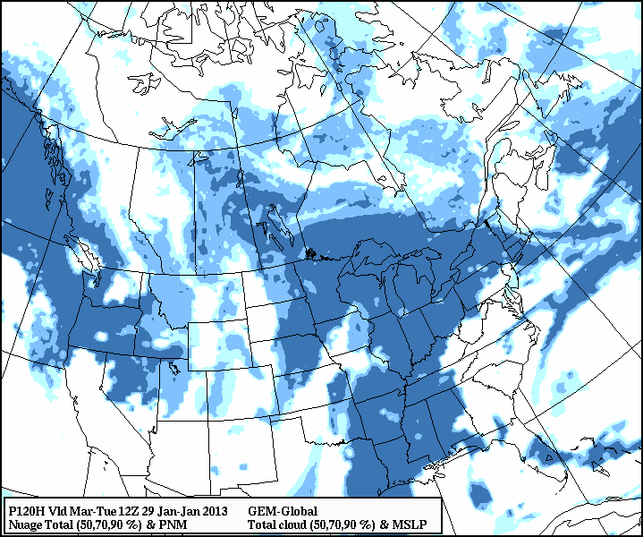
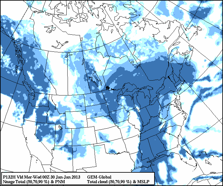
- GEM-glbl 132 hr fcst valid 00Z Wed 30 Jan. (cloud)
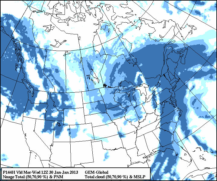
- GEM-glbl 144 hr fcst valid 12Z Wed 30 Jan. (cloud)
- GEM sees mainly clear skies Tuesday afernoon, but clouded over by 12Z Wed
-
- GEM-glbl 120 hr fcst valid 12Z Tues 29 Jan. (sfc wind)
- GEM-glbl 132 hr fcst valid 00Z Wed 30 Jan. (sfc wind)
- GEM-glbl 144 hr fcst valid 12Z Wed 30 Jan. (sfc wind)
- Noticeably windy Tuesday morning, easing off during the day
-
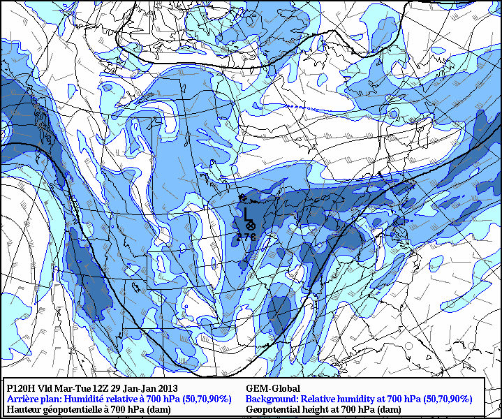
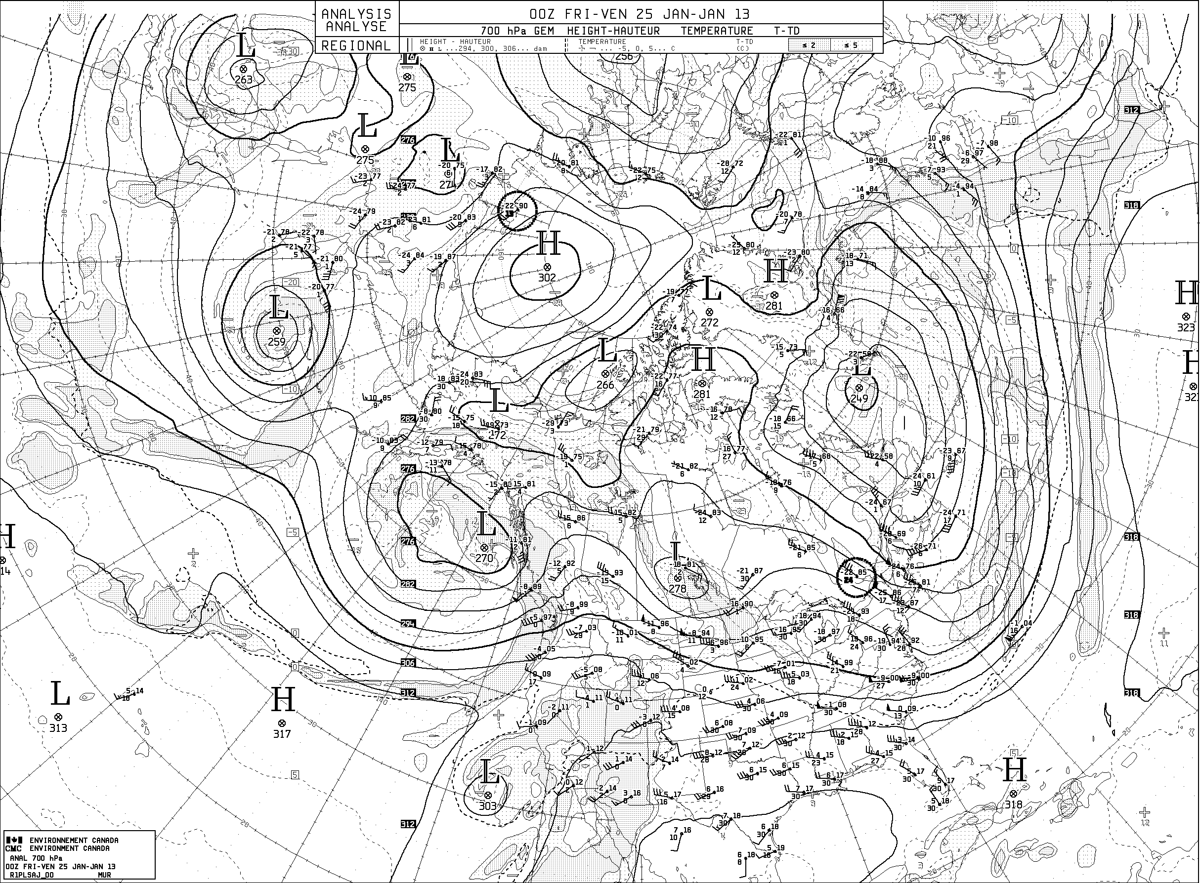
- GEM-glbl 120 hr fcst valid 12Z Tues 29 Jan. (upper flow - 700 hPa)
- Zones of high RH at 700 hPa. Wind aloft rather light.
-
- Meteogram based on GEM-glbl initialized 12Z Tues 24 Jan
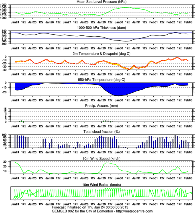
- Meteogram based on GEM-glbl initialized 00Z Tues 24 Jan
- Some minor variation between the older GEM prog (initialized 00Z) and the latest
-
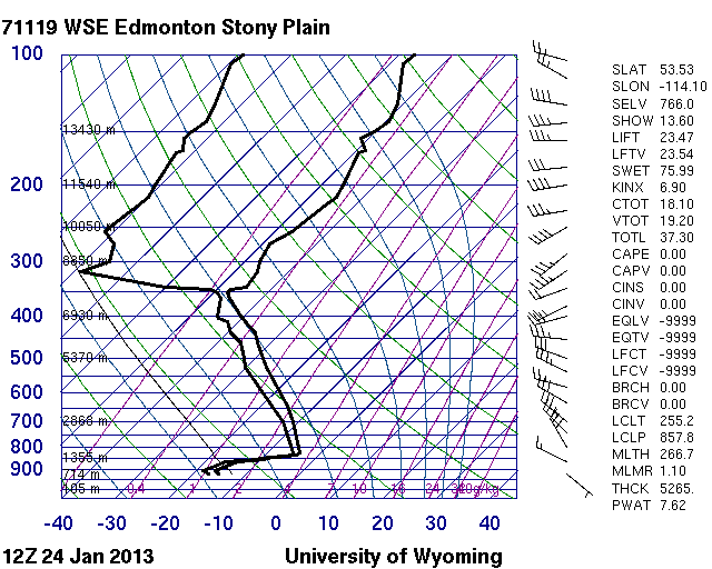
- Thickness at 12Z this morning (Tues 24 Jan.) was 527 dam (you can confirm this by retreiving the sounding). At 12Z on Tues 29 Jan., GEM anticipates it will be about 500 dam. This represents some 13 degrees of cooling (on average, below 500 hPa) relative to today
-
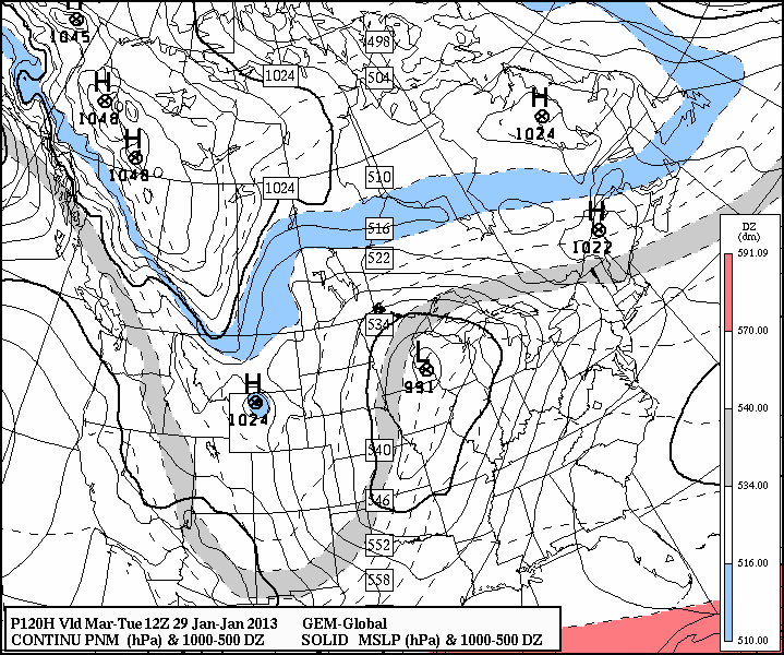
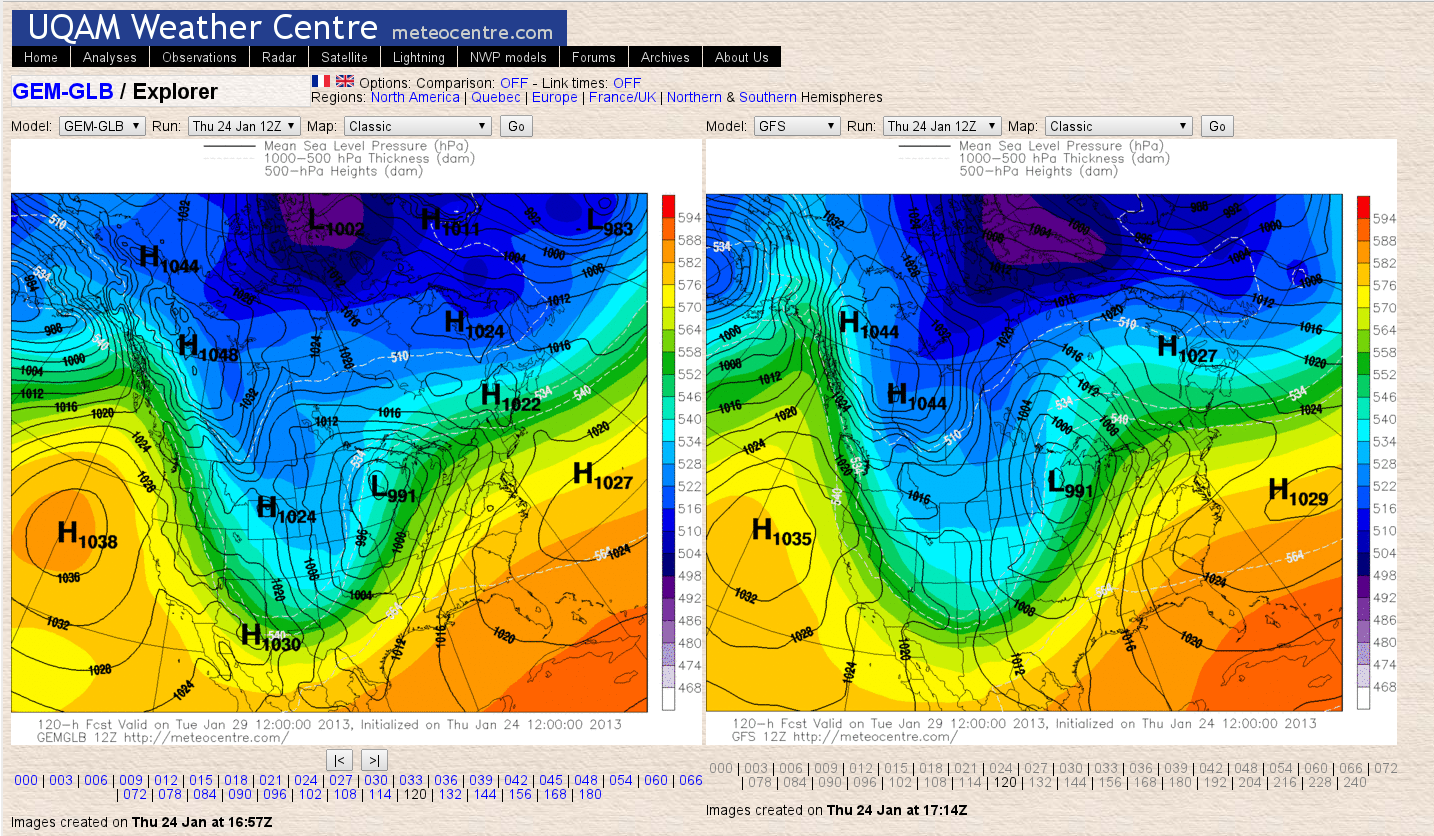
- Finally, let's use the UQAM site ("meteocentre") to display a side-by-side comparison of GEM and GFS progs for Tues 29 Jan (sfc isobars, thickness). The two progs are very consistent.
-
- Summary of anticipated conditions for 12Z Tues 29 - 12Z Wed 30th Jan. Becoming very cold by 12Z Tues, due to incursion of an arctic ridge. Cloudy early in the period, possible light snow. Clearing, then cloudy again by Wednesday morning. Some surface wind. Temperature abating.
Follow-up
- By Thursday afternoon we were into SW flow aloft which resulted in warm air aloft
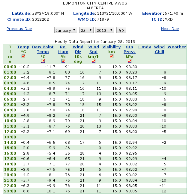
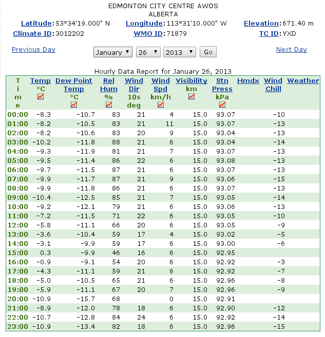
- Here are the hourly observations from YXD (Edmonton City Centre) on Friday 25, Saturday 26, Sunday 27
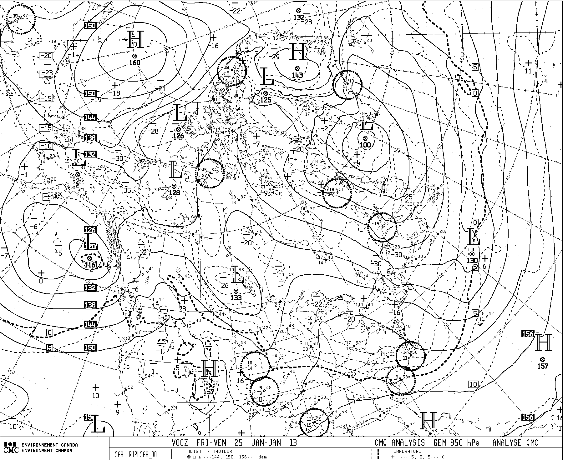
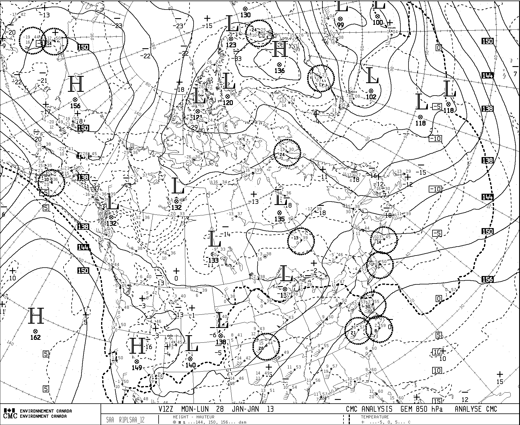
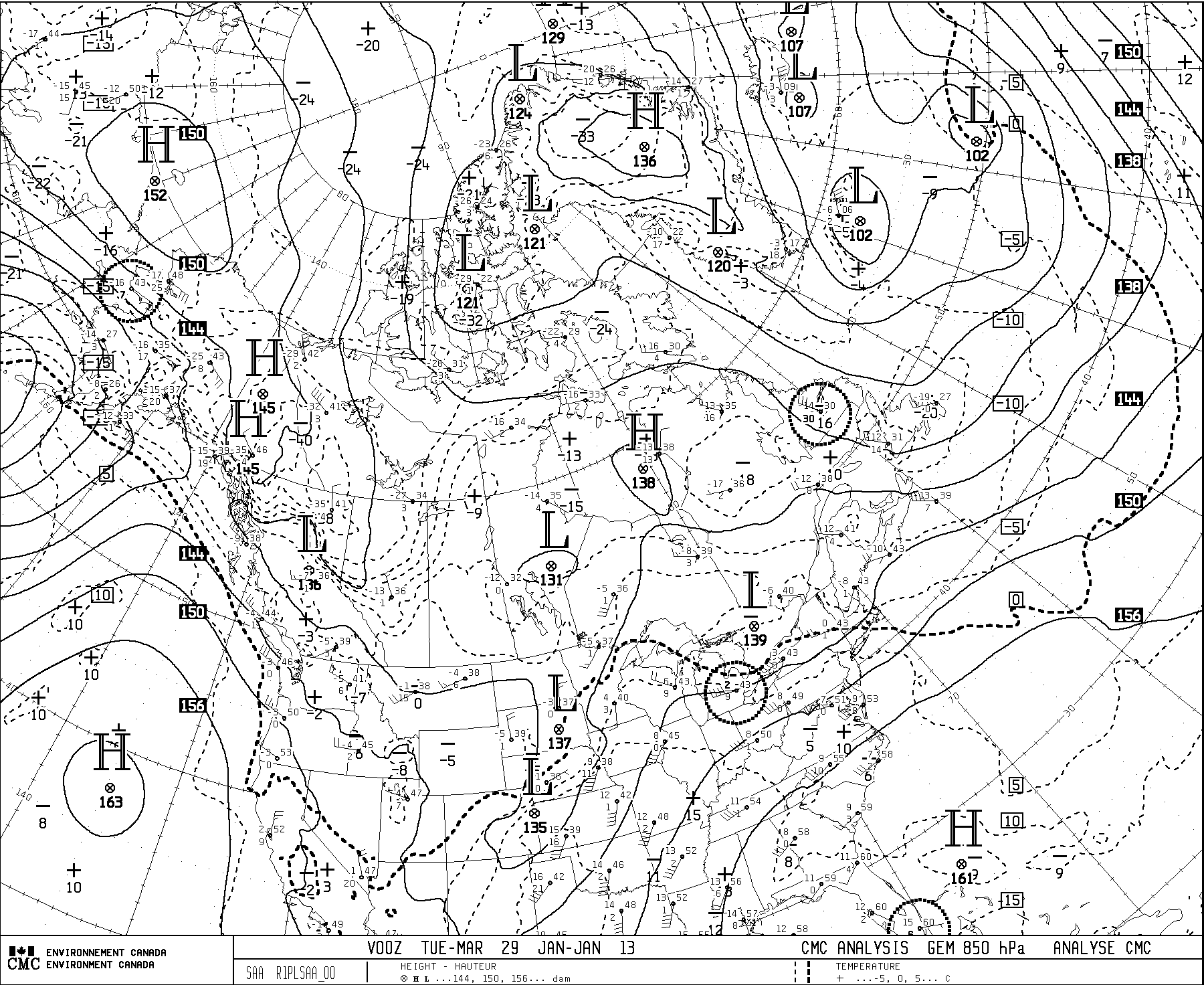
- 850 hPa analysis 12Z Monday 28 Jan -- poised for cooling -- 850 hPa analysis 00Z Tues 29 Jan
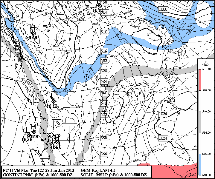
- GEM-rgl 24 hr fcst valid 12Z Tues 29 Jan. 2013 -- pattern is consistent with that anticipated at 120 hr lead time
- EC 7:00 AM CST SATURDAY JANUARY 26 2013. SOME VERY COLD ARCTIC AIR IS IN PLACE FROM ALASKA INTO THE WESTERN TERRITORIES, AND THIS COLD AIR WILL START WORKING ITS WAY SOUTHWARD INTO NORTHERN ALBERTA ON SUNDAY AS A STRONG HIGH PRESSURE AREA STARTS BUILDING SOUTHWARD. IT WILL EVENTUALLY SPREAD ACROSS ALL OF THE PRAIRIES OVER THE FOLLOWING FEW DAYS PLUNGING TEMPERATURES BACK TO WELL BELOW NORMAL VALUES.
- EC 7:00 AM CST MONDAY JANUARY 28 2013... THE MAIN WEATHER STORY FOR THE NEXT 24 HOURS WILL BE THE COLD ARCTIC AIR THAT SITS OVER NORTHERN MACKENZIE. THIS AIR WILL PLUNGE INTO ALBERTA TODAY AND THROUGH THE REST OF THE PRAIRIES BY MID WEEK.
-
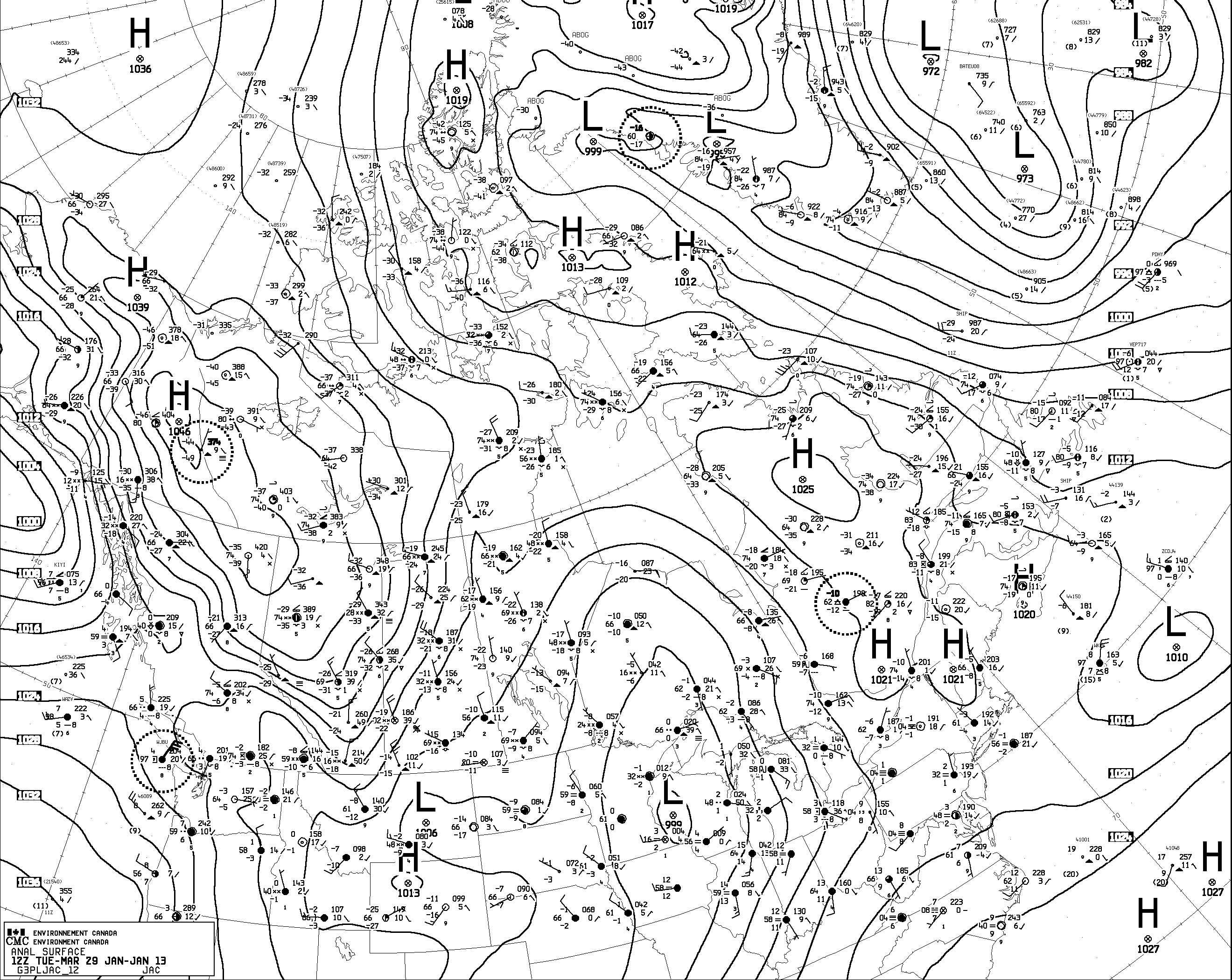
- Surface analysis 12Z Tues 29 Jan. 2013
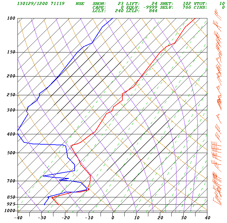
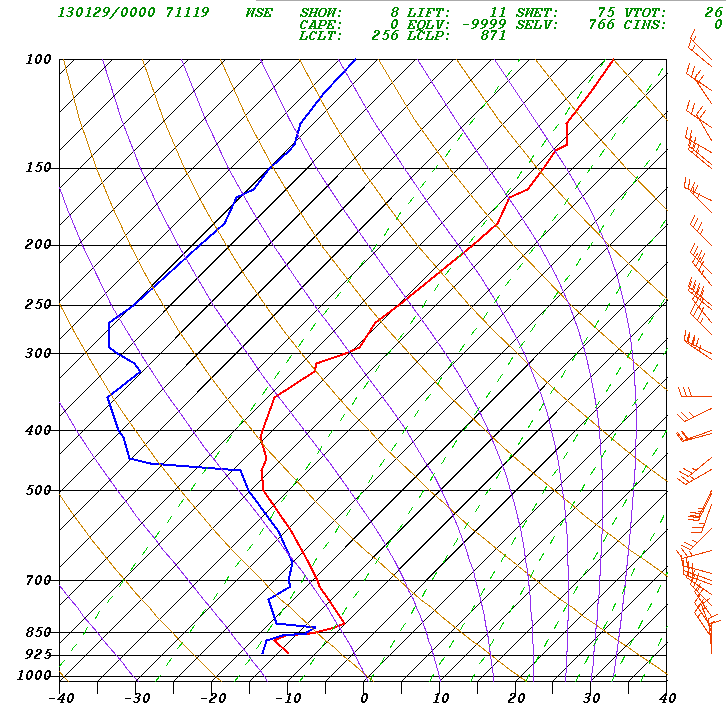
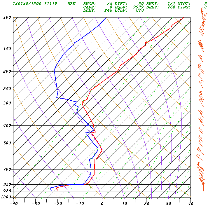
- Stony Plain (wse) sounding 12Z Tues 29 Jan. Note the well-mixed layer below 850 hPa (temperature lapse rate parallels dry adiabat, i.e. height-invariant potential temperature), due to the wind. Comparing with 00Z sounding we see about a 10 degree drop in sfc temperature overnight (presumably due to a combination of advective and radiative cooling)
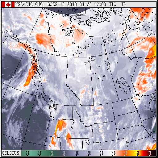
- GOES IR image (12Z Tues 29 Jan.)... animation showed that there is at least some low cloud over C. Alberta.
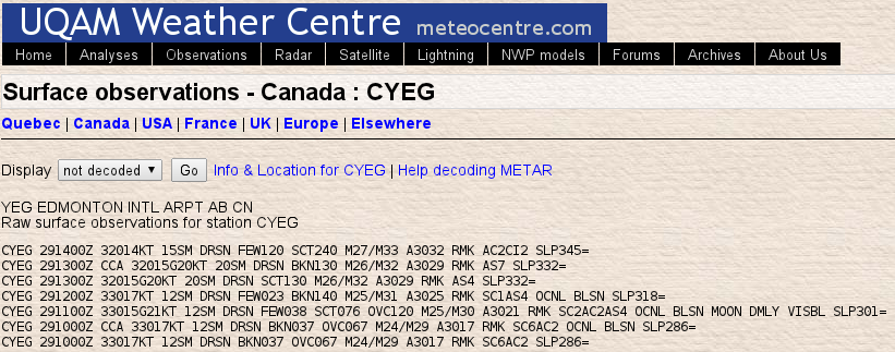
- METARs from CYEG
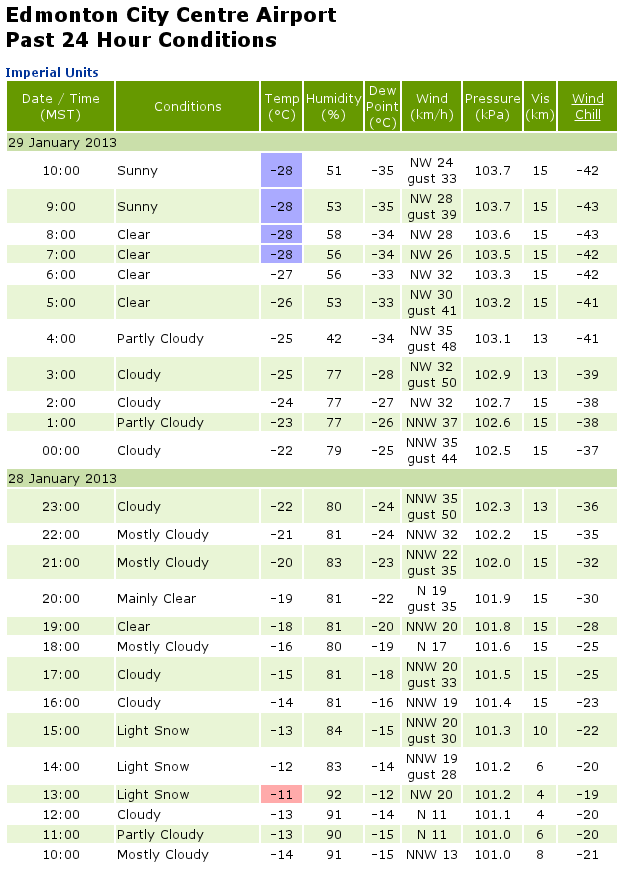
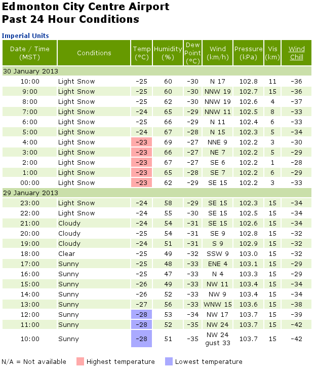
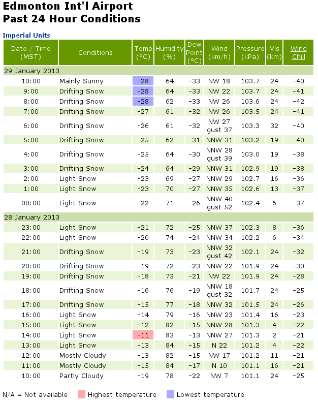
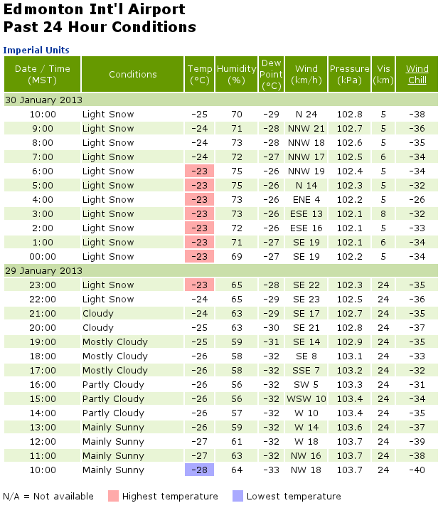
- Hourly weather data at Edmonton City Centre Airport (YXD) and update through Wednesday evening; and at Edmonton International Airport (YEG) with update through Wednesday evening
- Sounding 12Z Wednesday (again, note the ground-based layer that is well mixed by the turbulent near-ground wind)
-
- The forecast statement (above) proved accurate in terms of the cold temperature, abating somewhat; it correctly anticipated the wind, and the redevelopment of cloud; it missed the light snow (a few cm) occurring overnight into Wednesday.
Back to the EAS 372 home page.
Link to Earth & Atmospheric Sciences home page.
Last Modified: 30 Jan., 2013