Classic Alberta Weather Situations -- some Examples
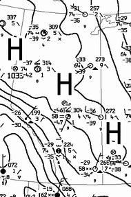
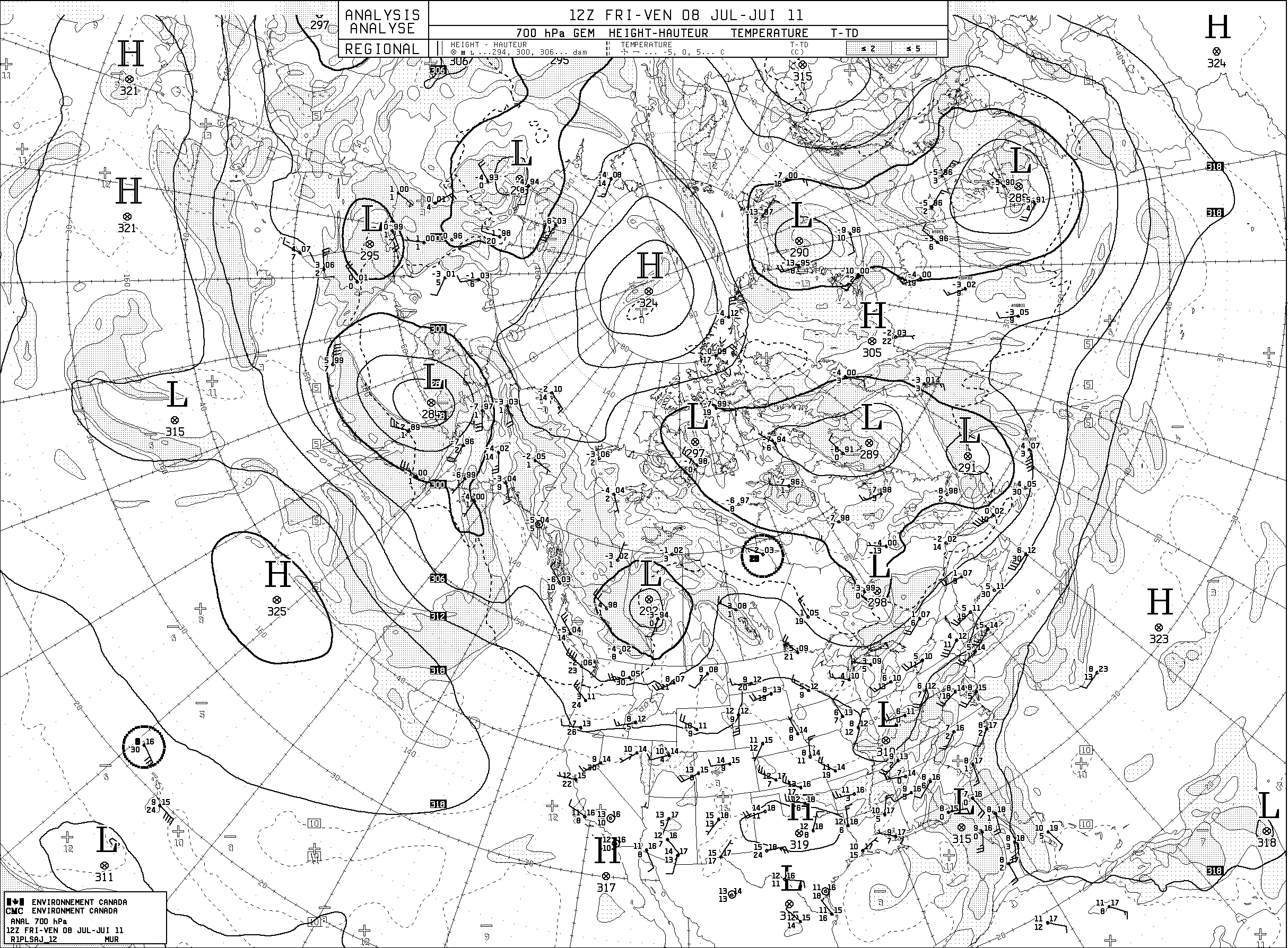
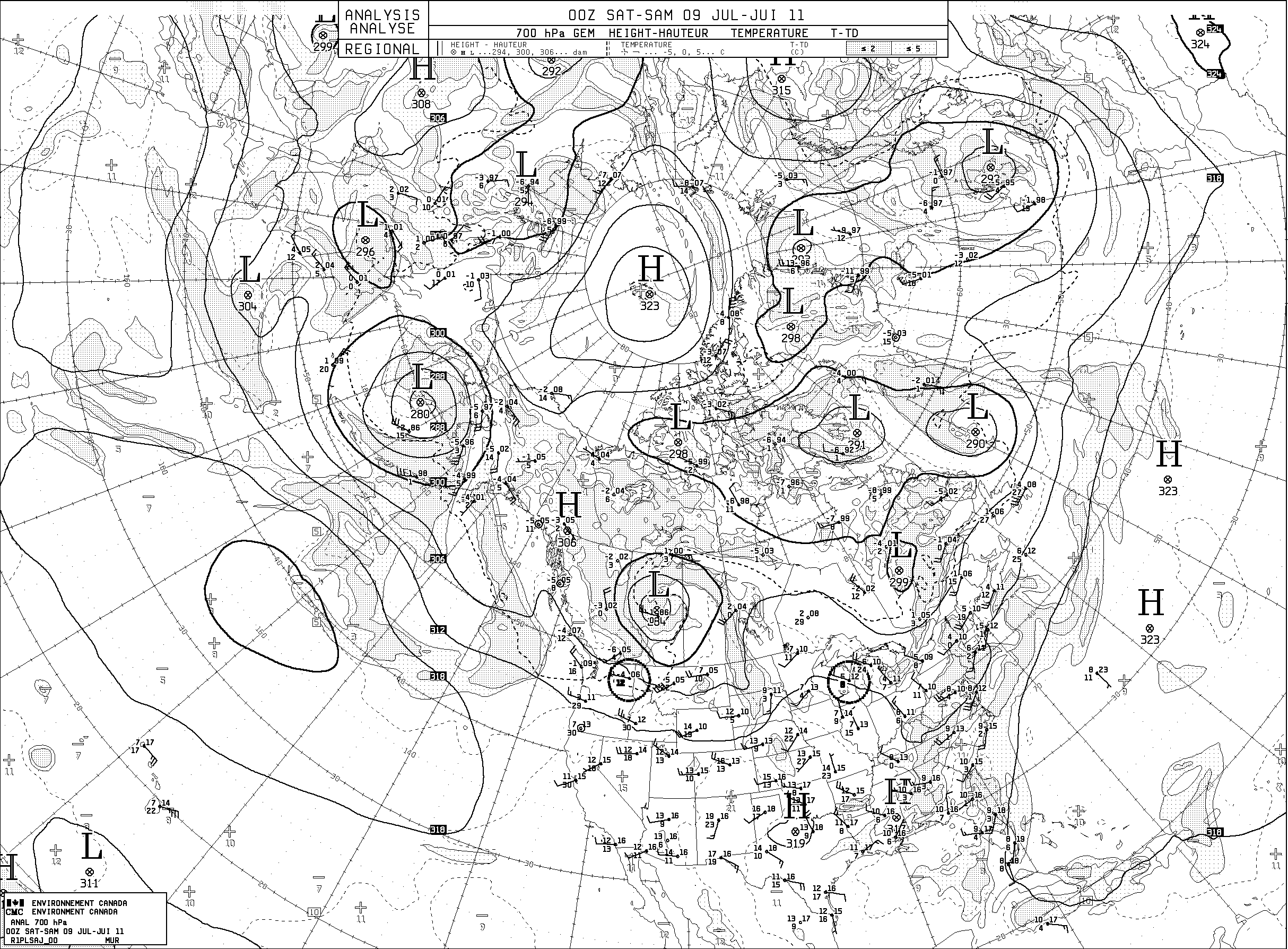
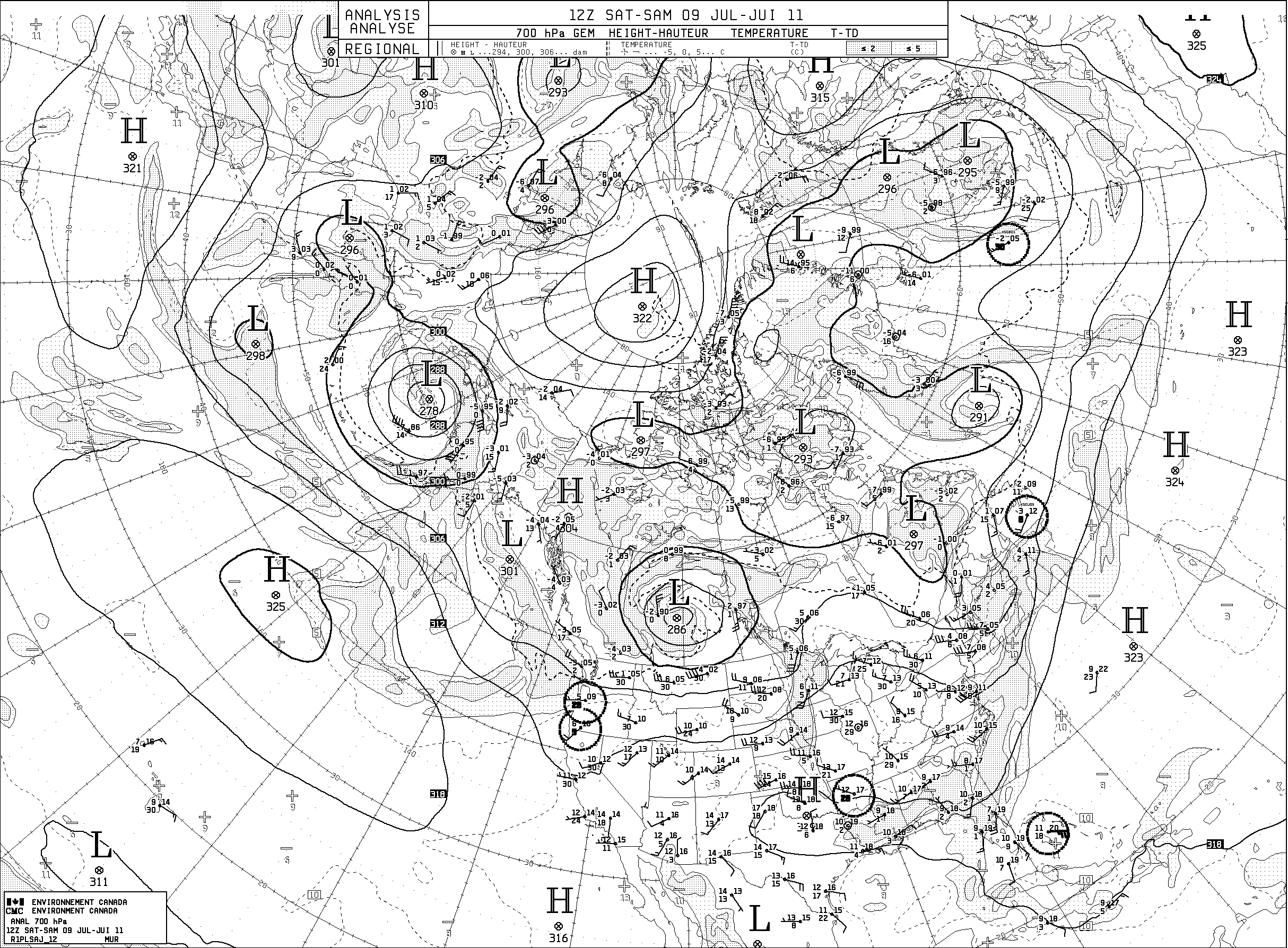
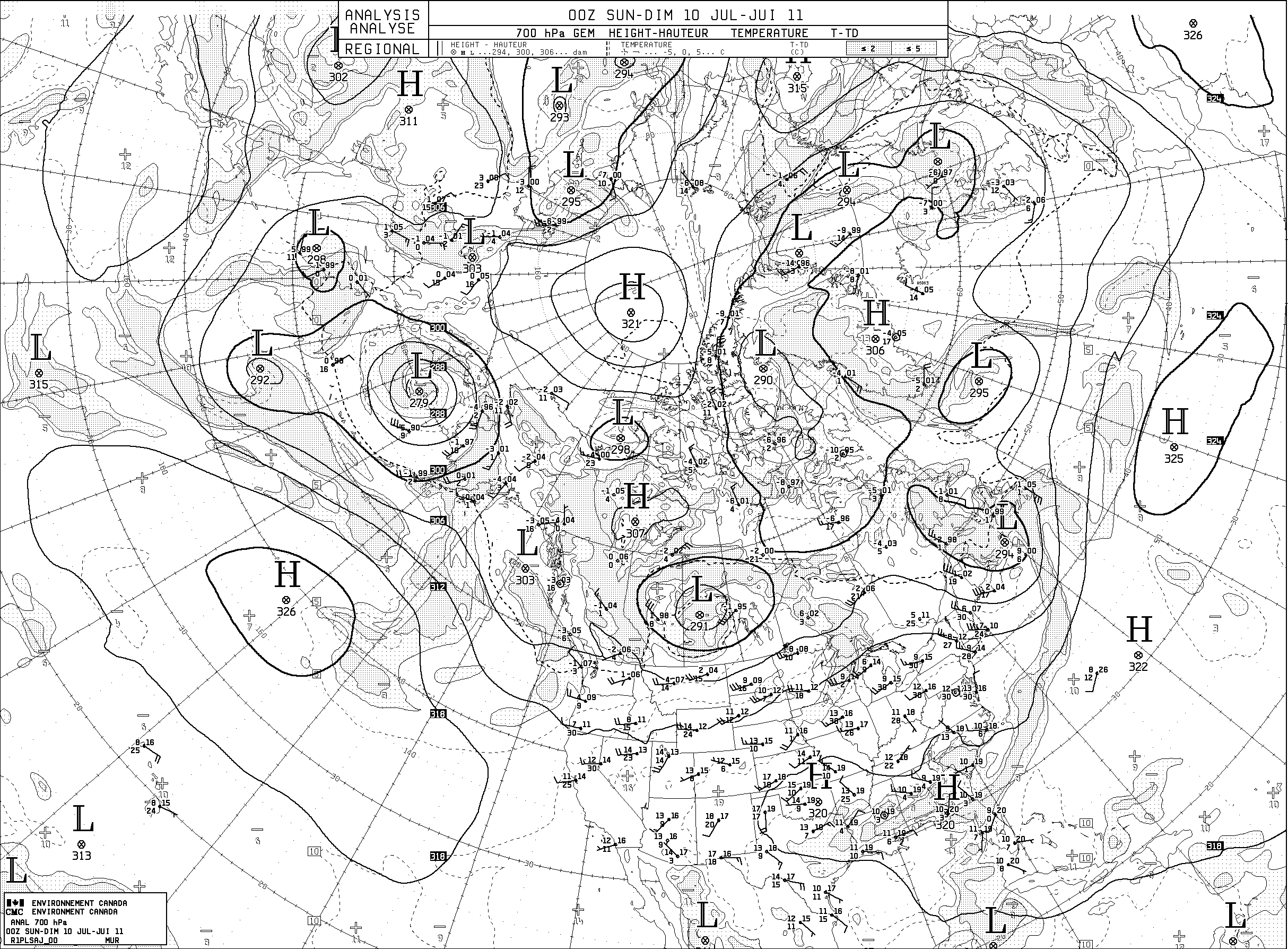
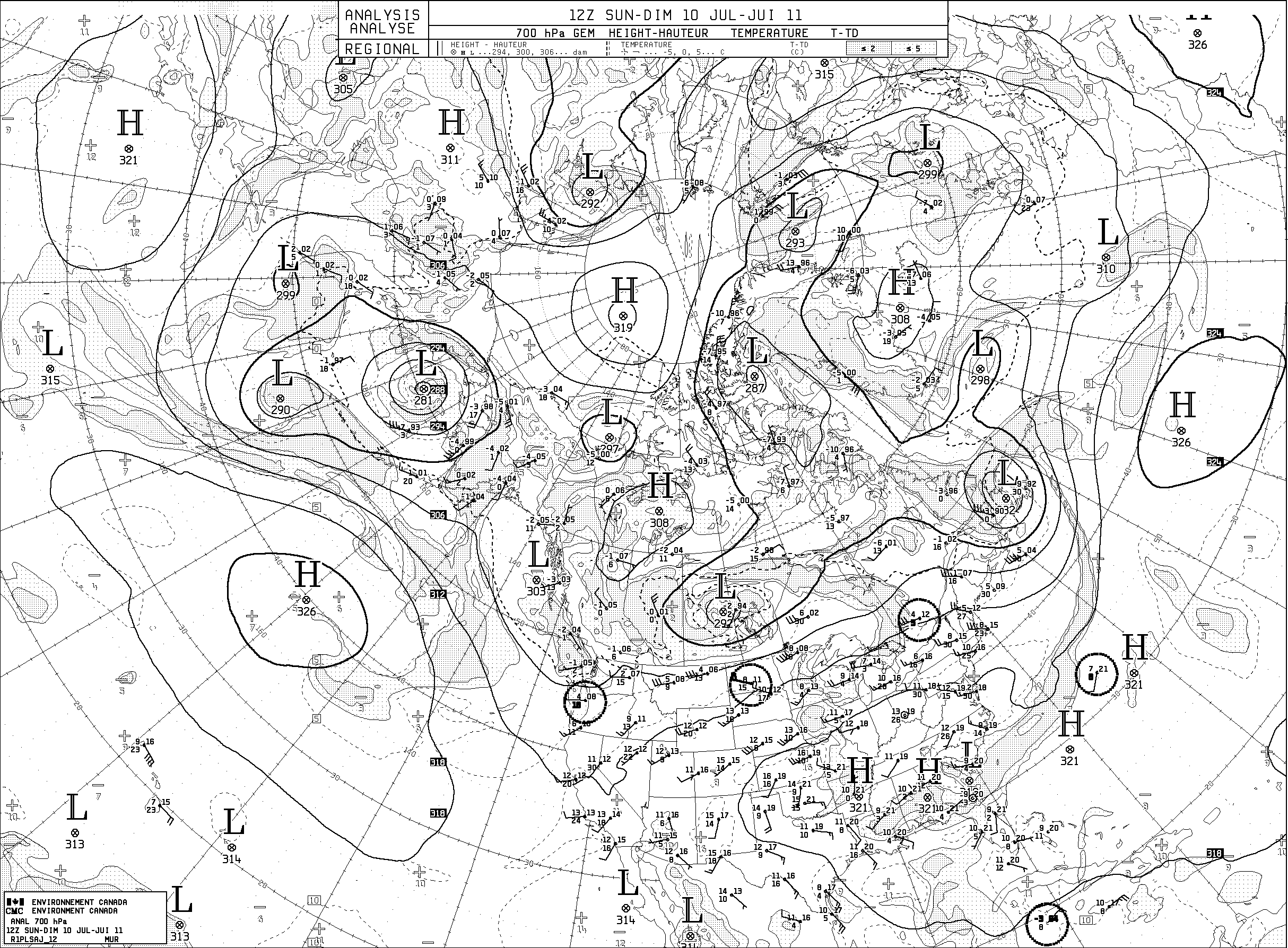
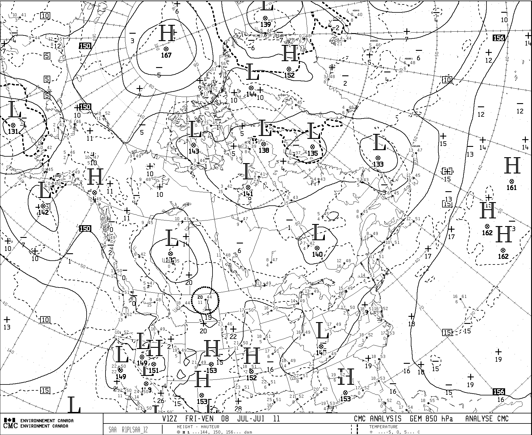
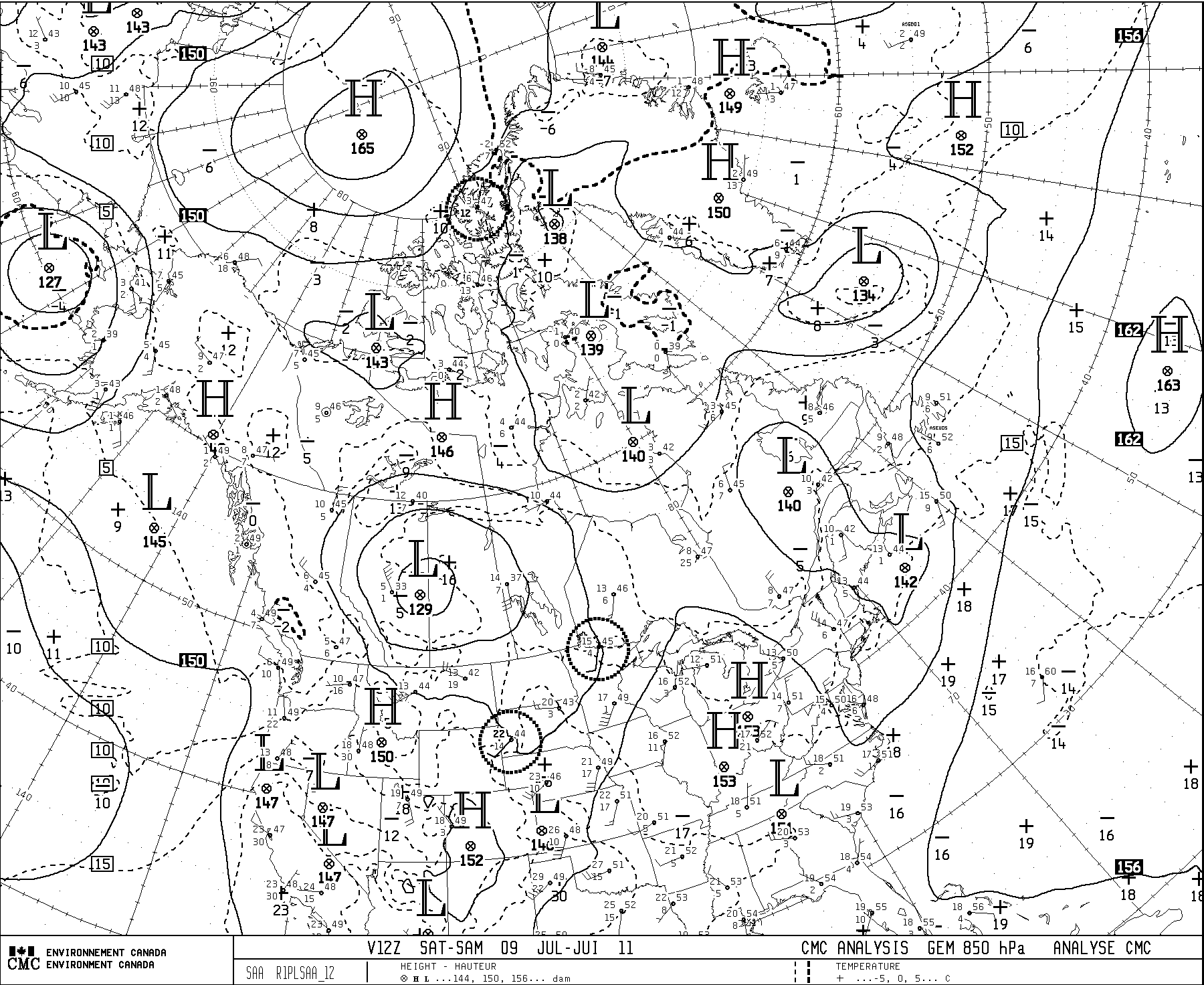
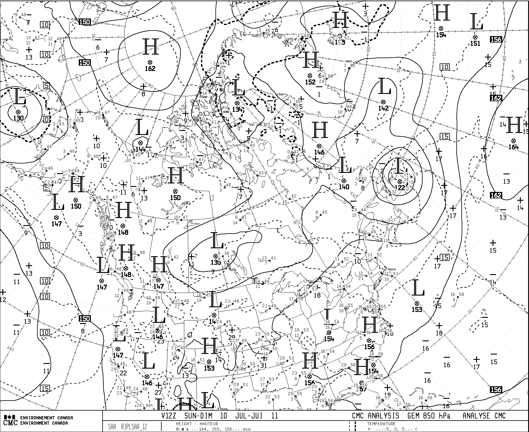
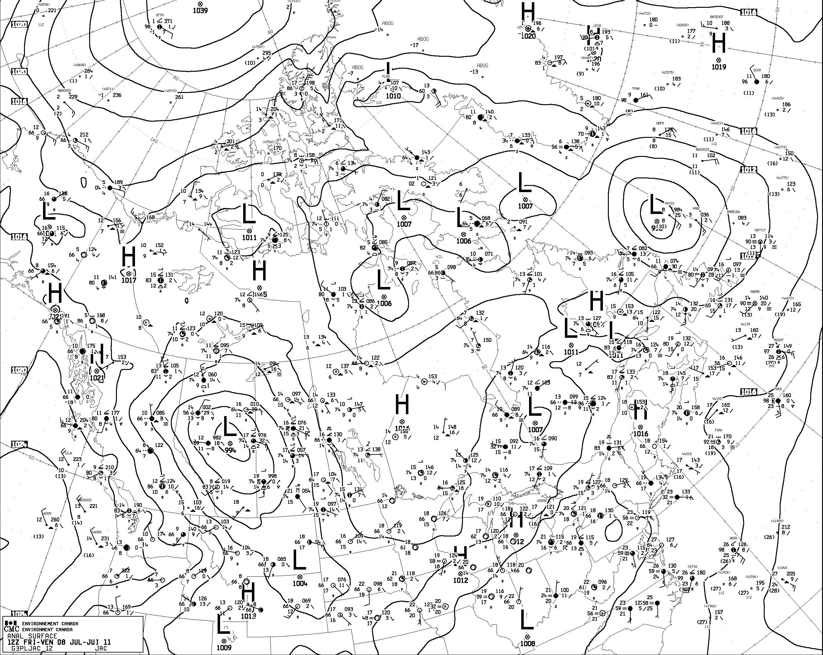
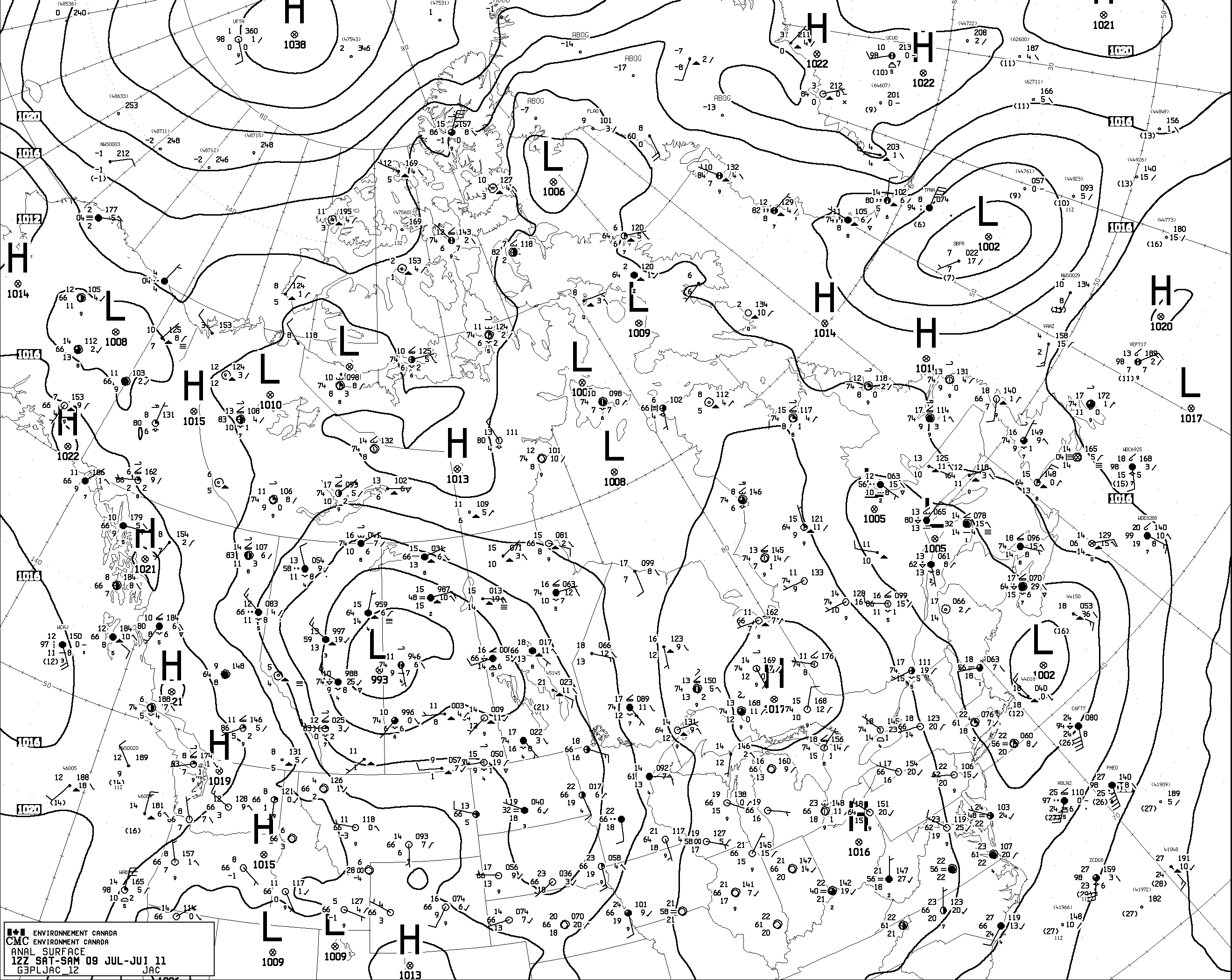
Slow-moving closed upper low produces cool, wet summer weather
8-9 July, 2011
- 700 hPa level
- 850 hPa level
- sfc level
- Observed weather
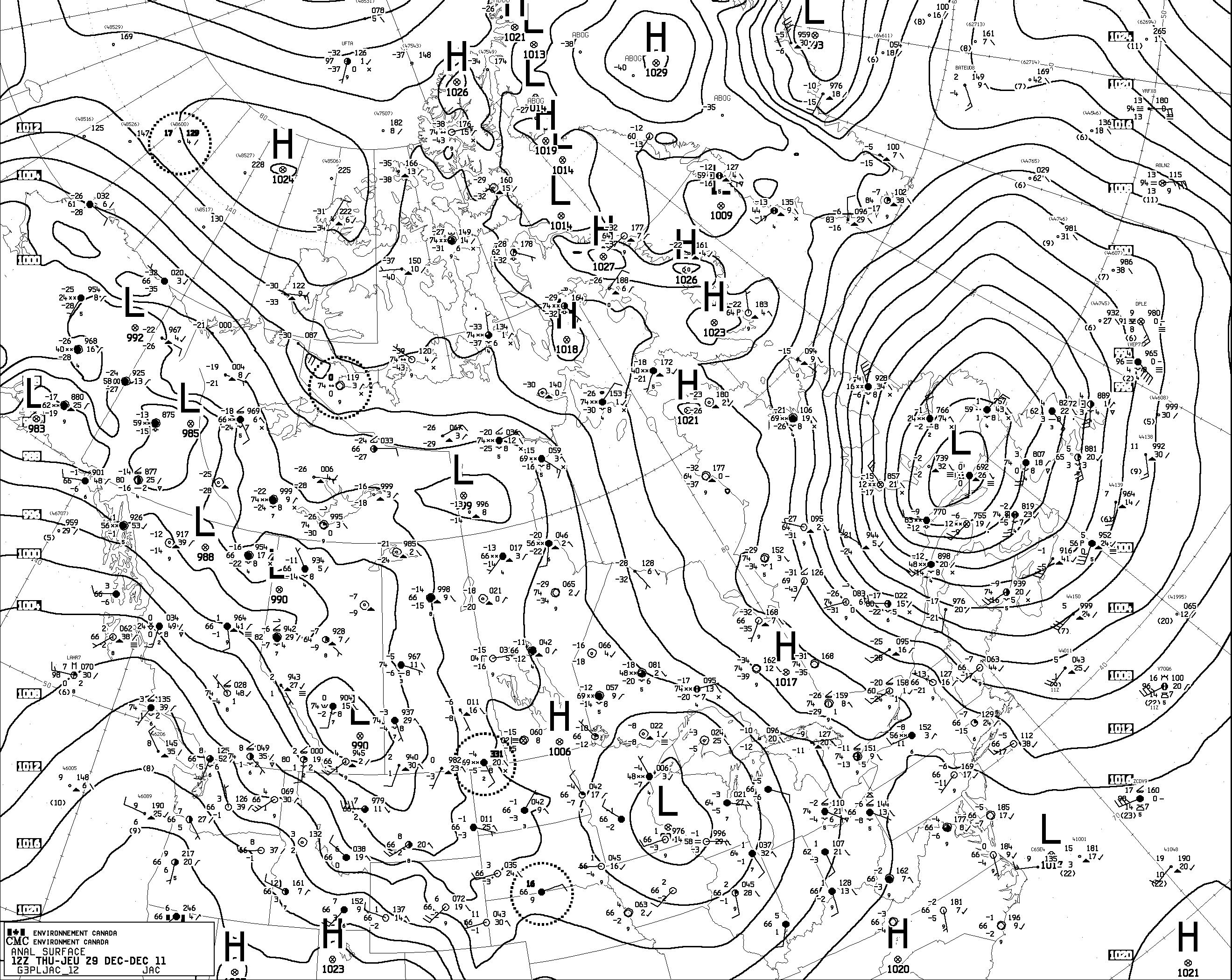
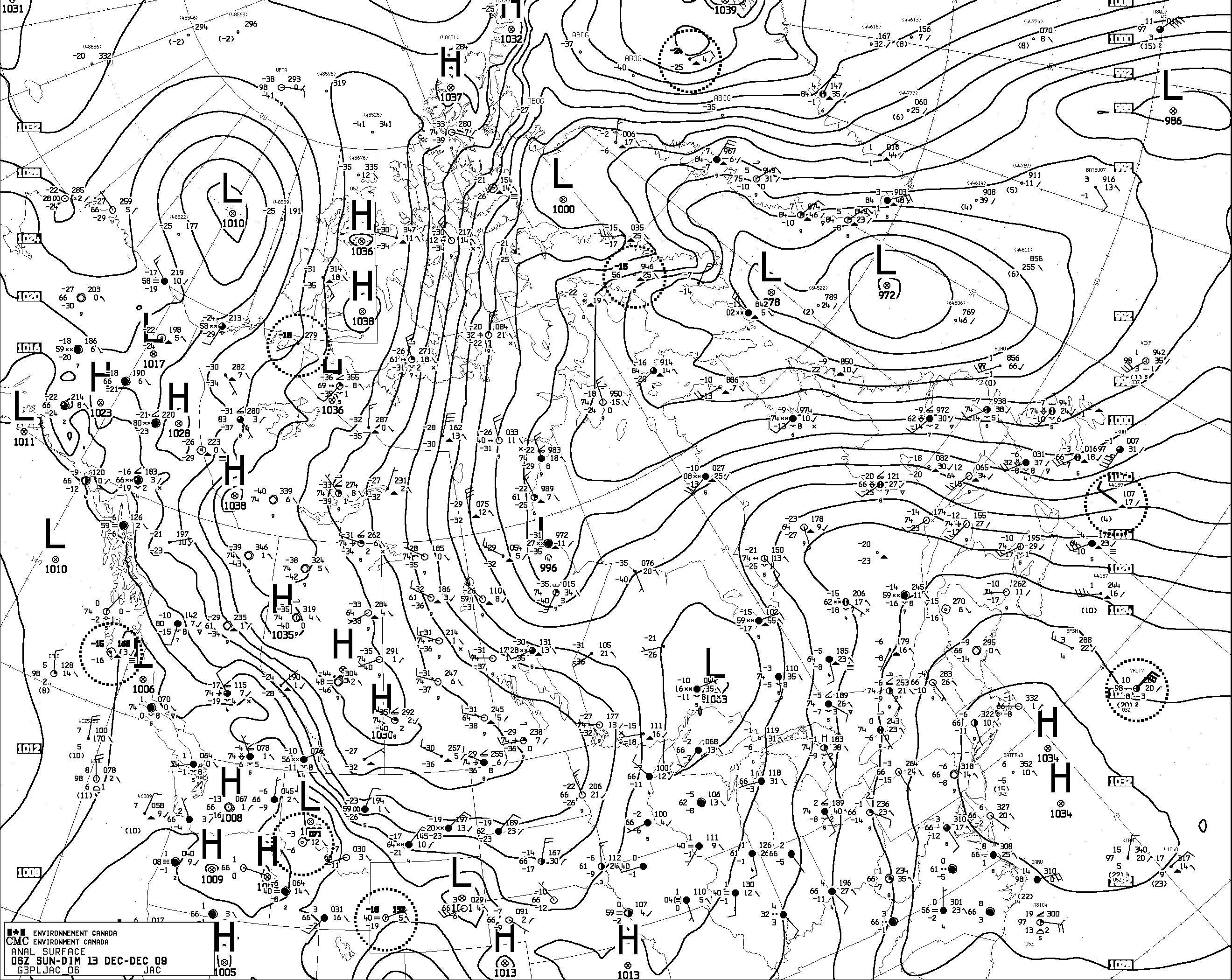
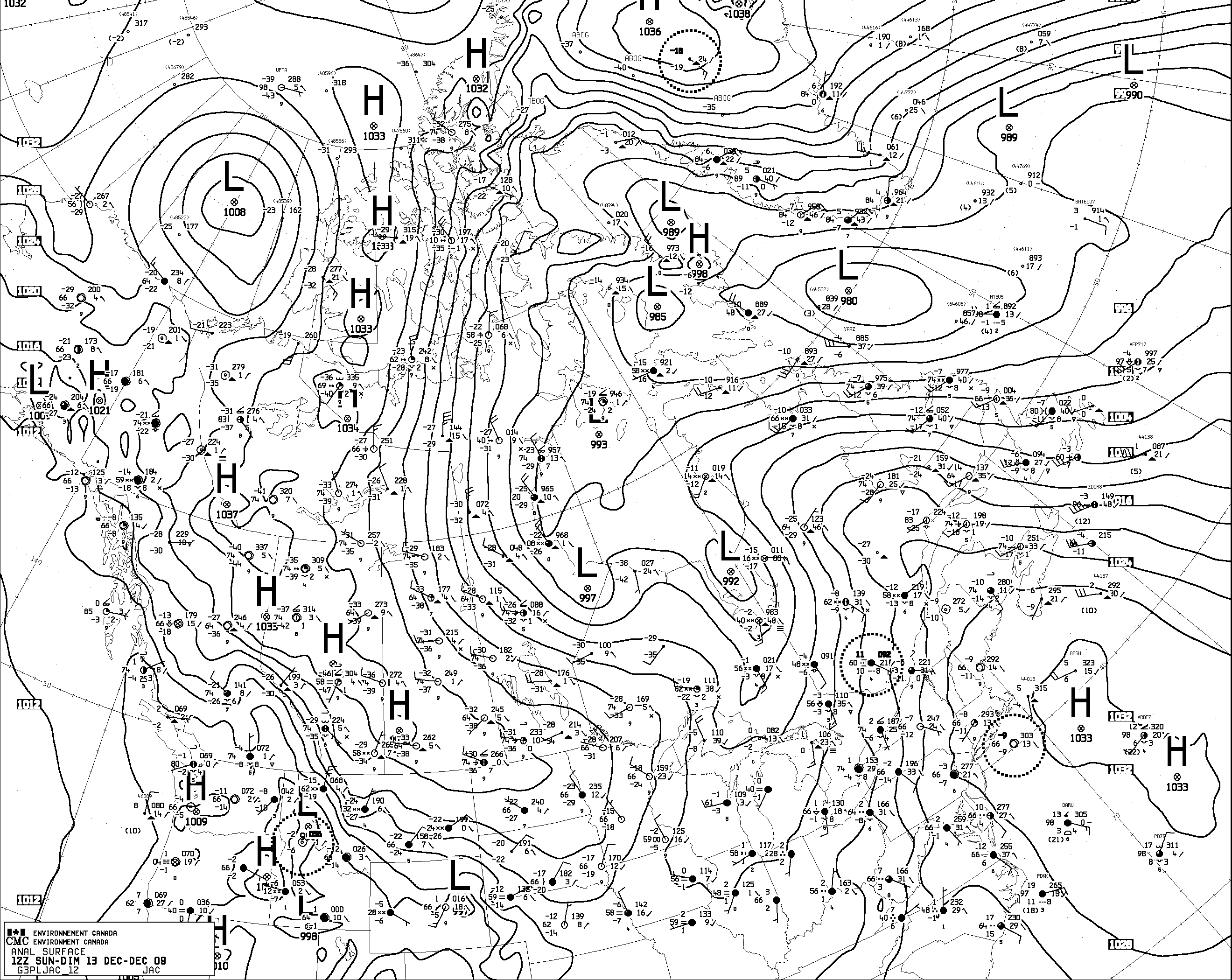
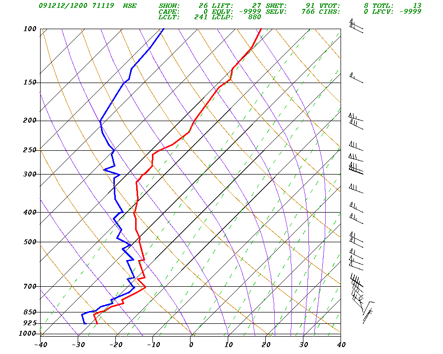
Freezing Rain
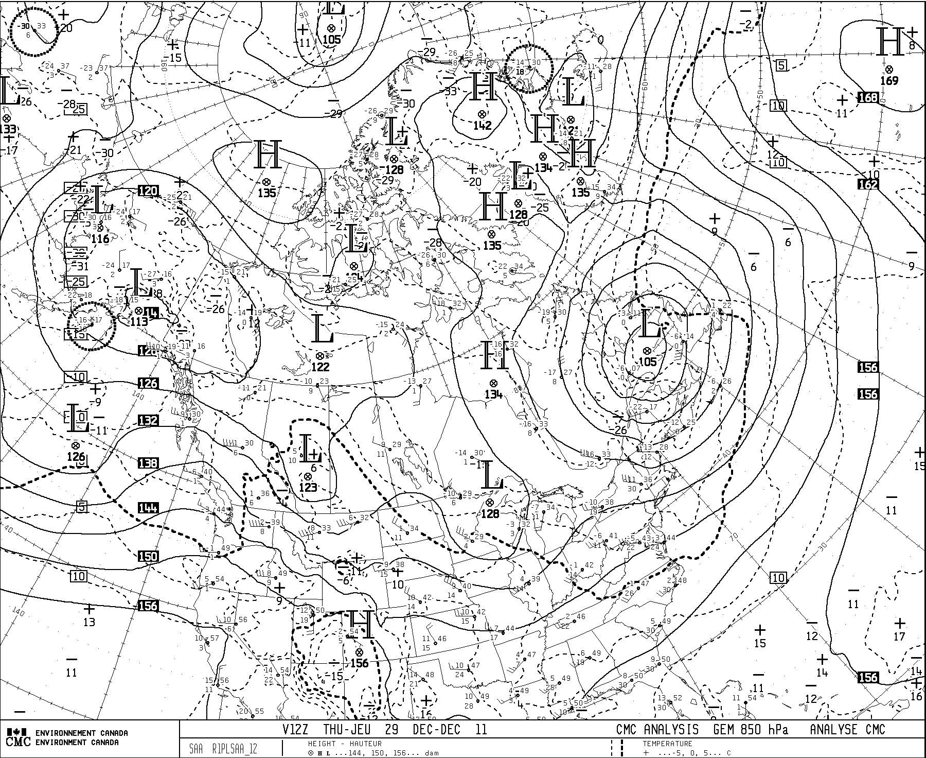
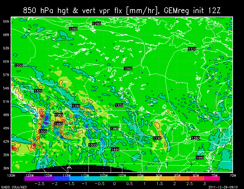
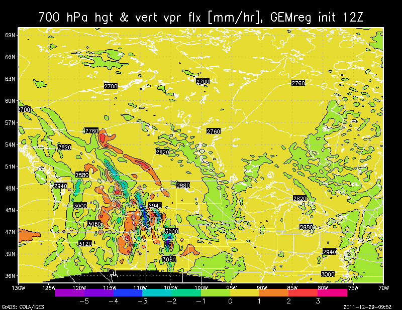
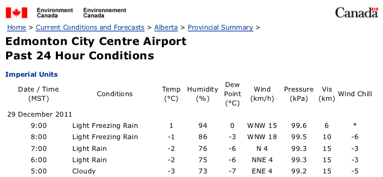
29 Dec., 2011
- Surface
- 850 hPa level
- 700 hPa level
- vert moisture flux, from 0hr GEM prog valid 12Z 29 Dec (spots of large upward flux in C. Alberta)
- Sounding
- Observed weather
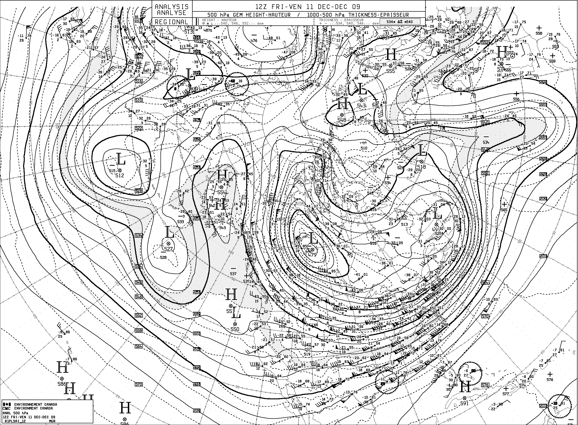
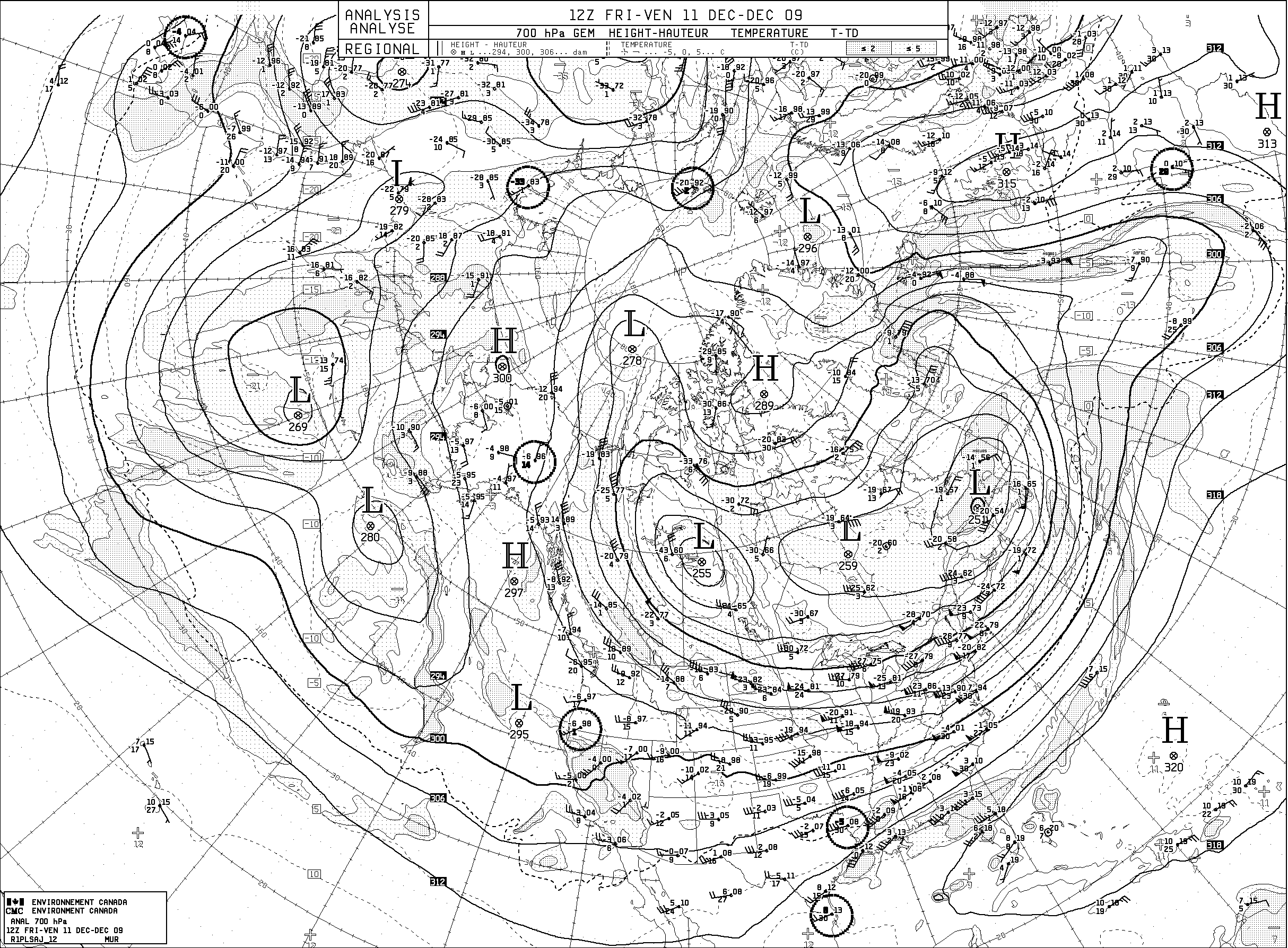
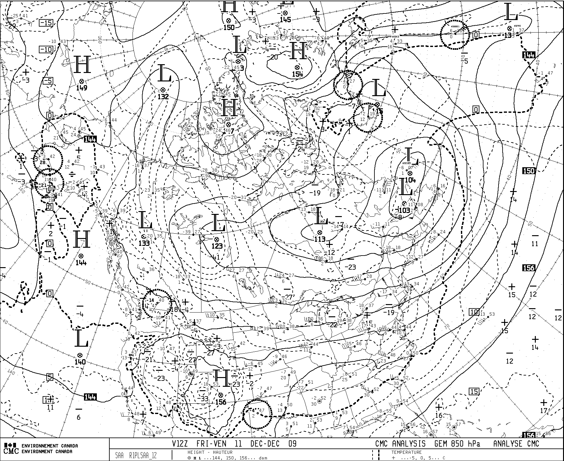
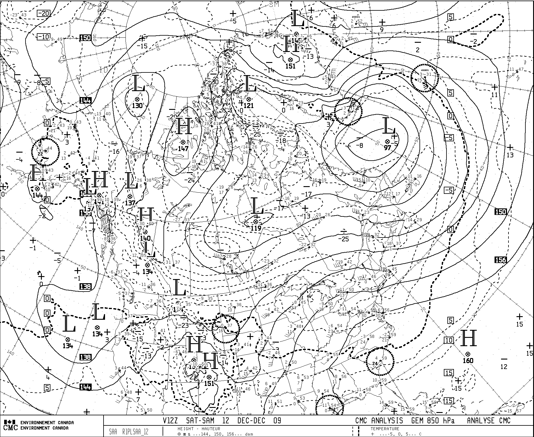
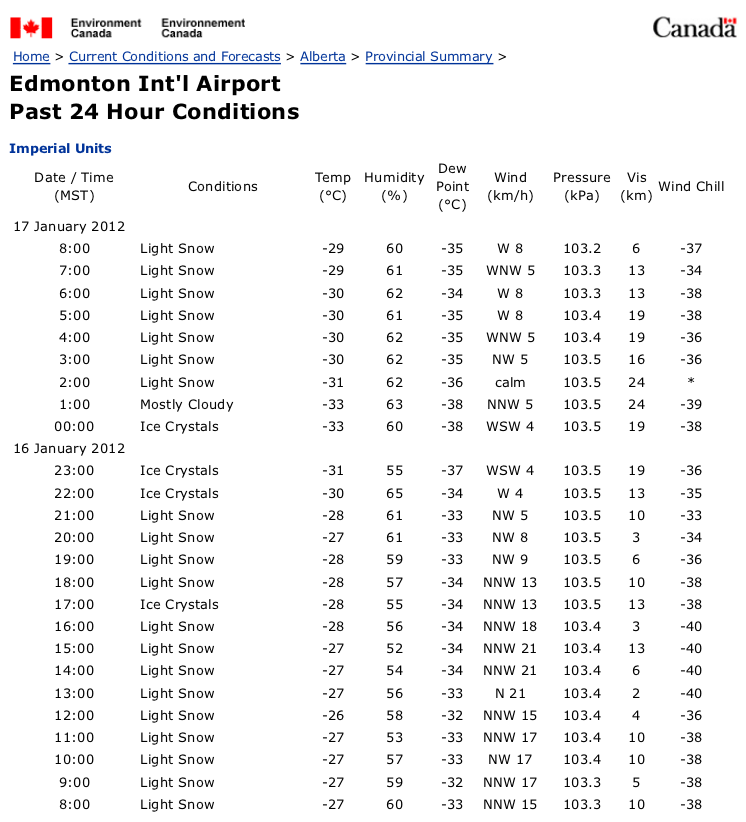
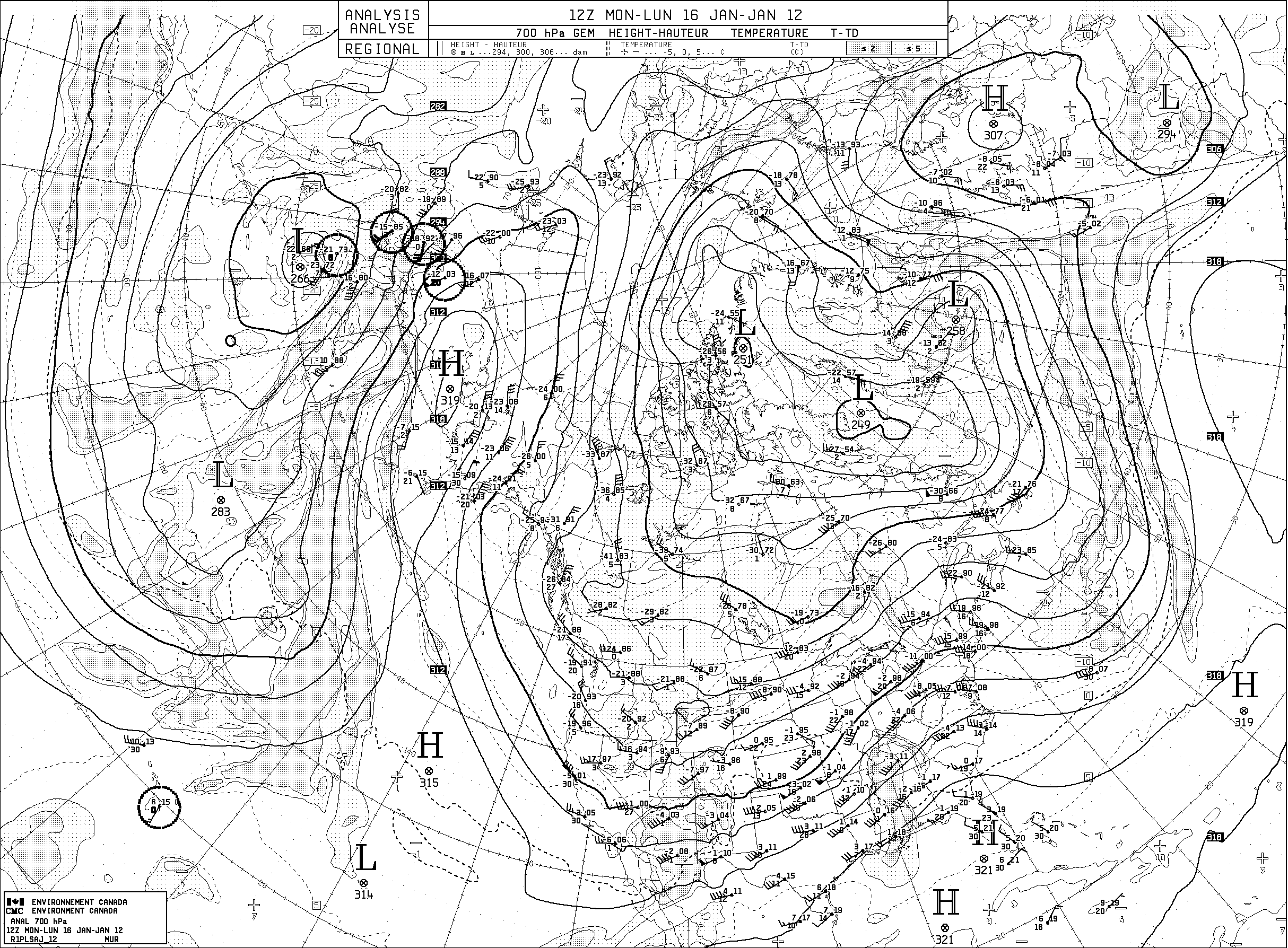
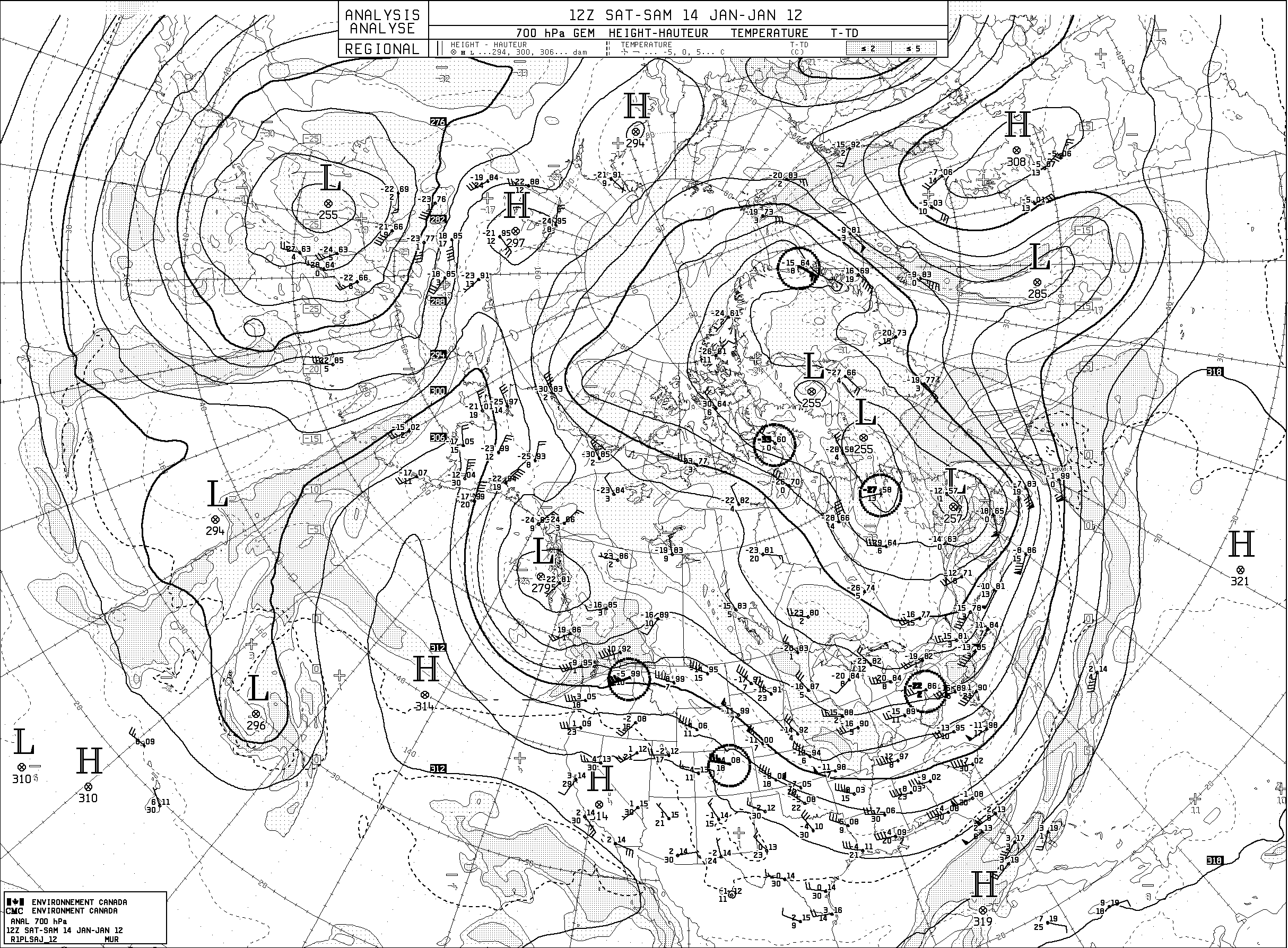
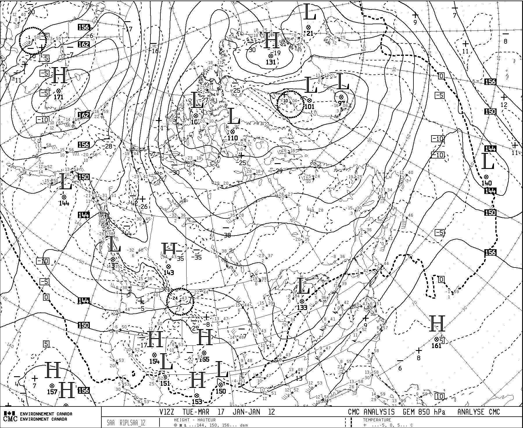
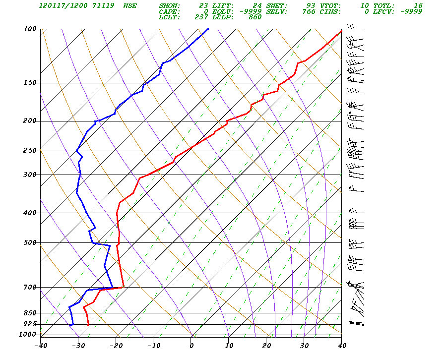
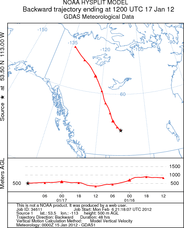
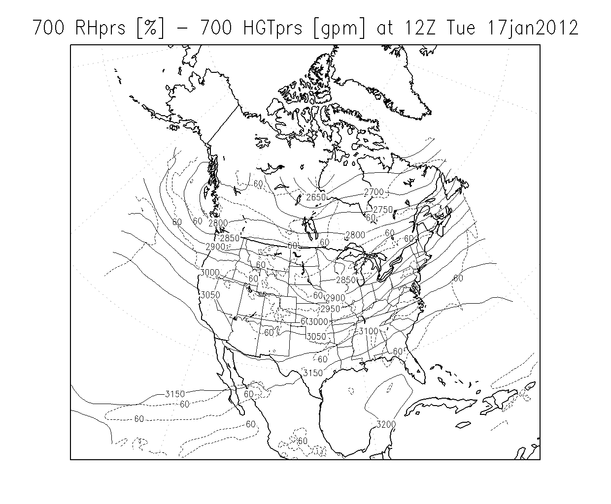
Extreme Winter Cold
Typically the cause is a sustained northerly upper flow due to a low in NE Canada, e.g. 1 Feb. 2007 (note that we are on the cold side of an Omega block). Typically when an "arctic vortex" in NE Canada sweeps cold air down, we escape the worst of it, e.g. note here the isotherms at 850 hPa on 5 Feb. 2007.
9 Dec. 2009
17 Jan. 2012
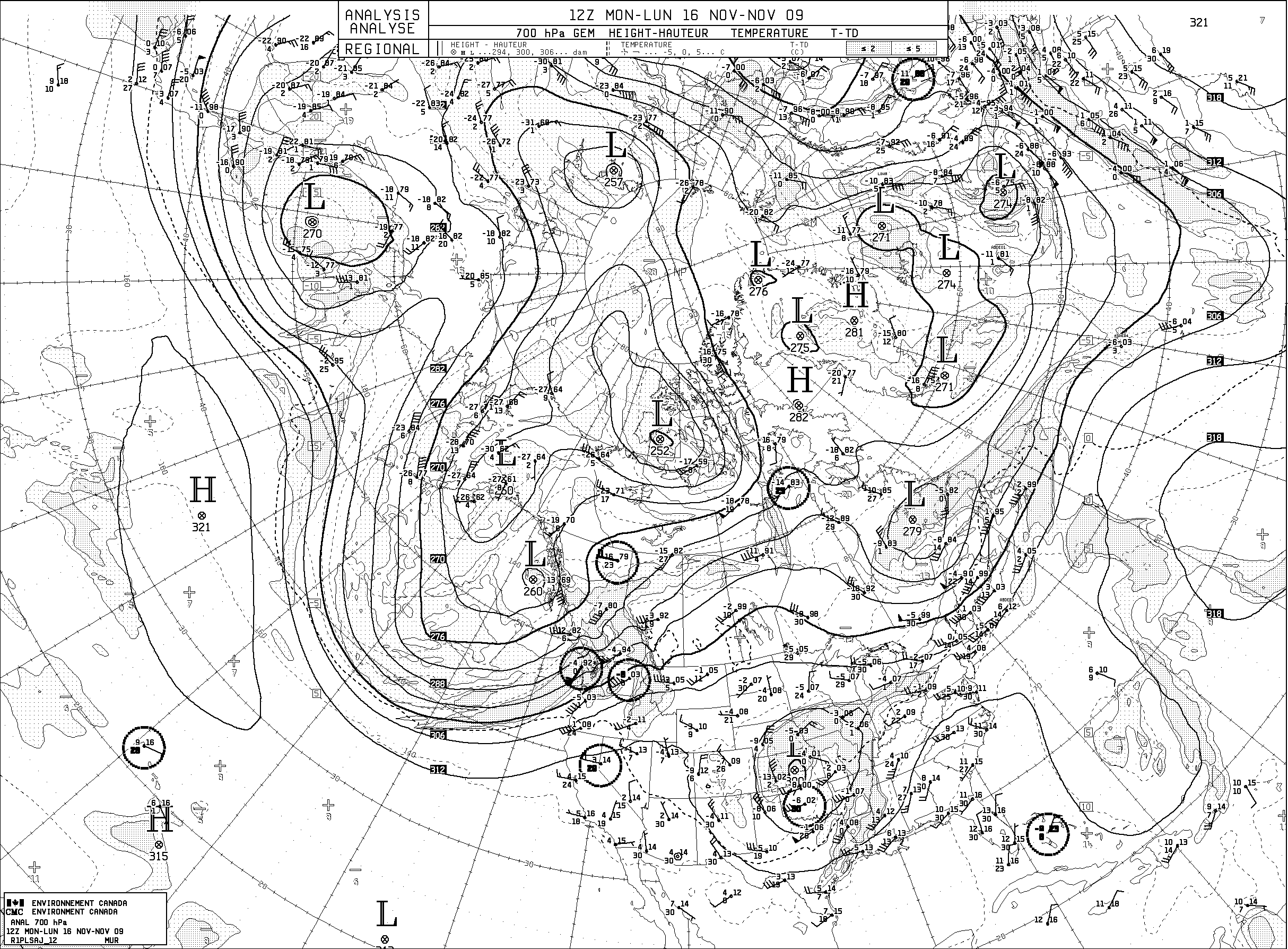
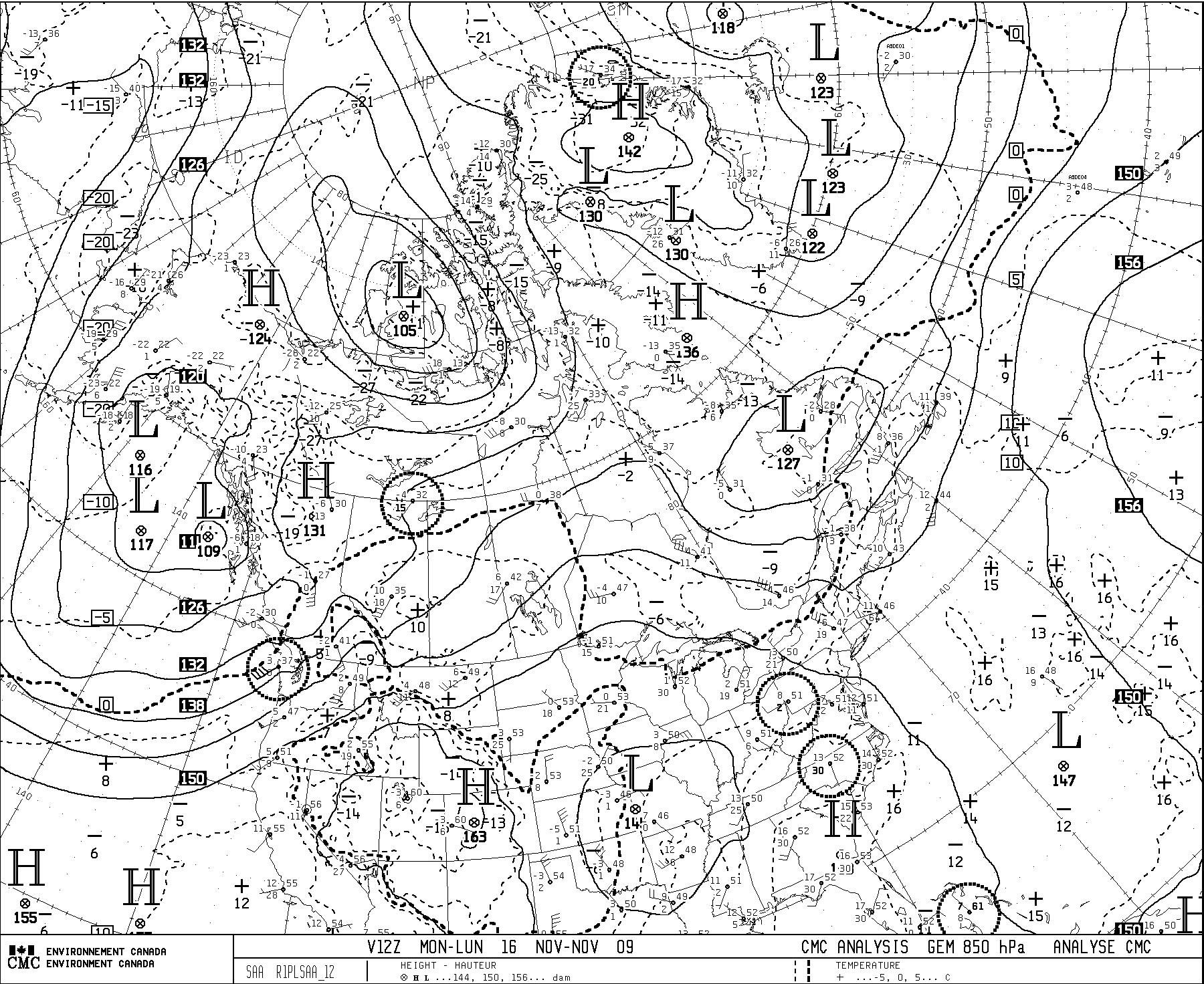
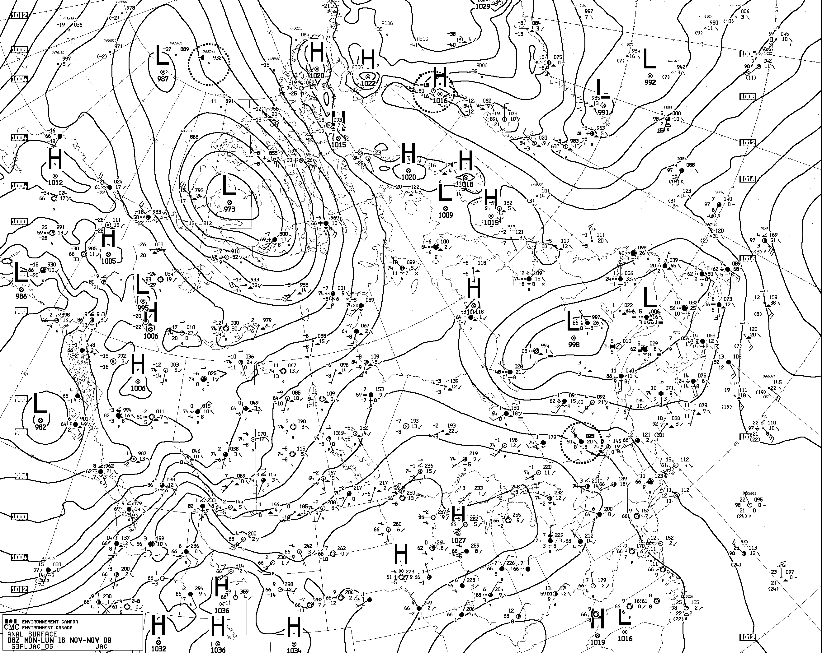
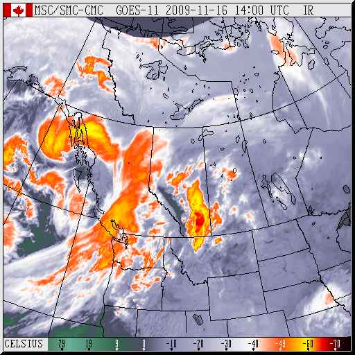
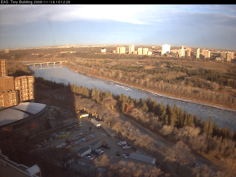
Late fall mild spell -- courtesy of lee trough
16 Nov. 2009
Often it is the SW flow that makes temperatures much, much warmer in Alberta than further to our east, e.g. 4 Mar. 2007.
22 Nov. 2011
Back to the EAS 372 home page.
Link to Earth & Atmospheric Sciences home page.
Last Modified: 2 Jan., 2013