EAS372 -- Archive of NWP data used for forecasts, and of analyses etc. for subsequent forecast verification -- 2015
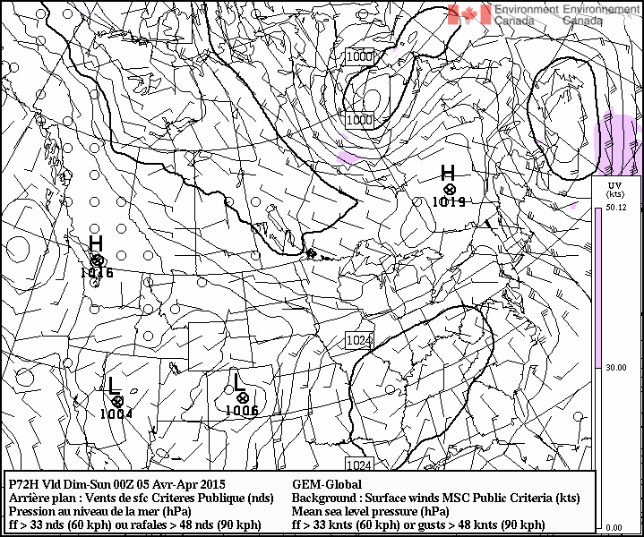
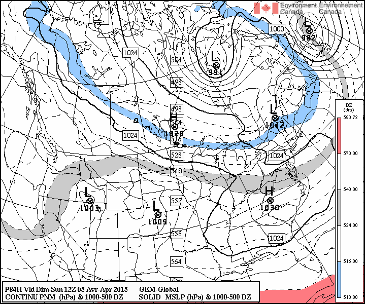
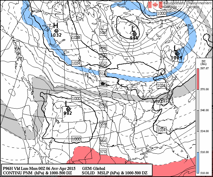
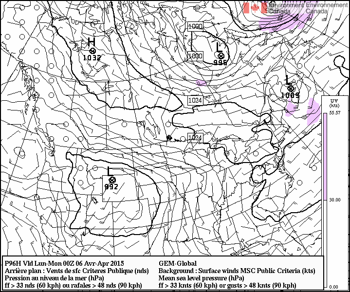
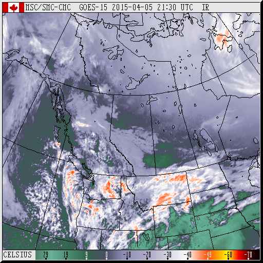
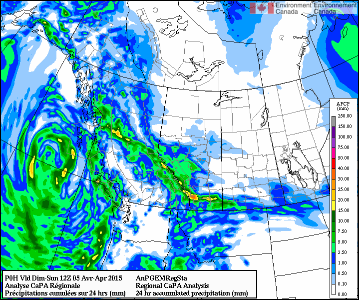
Available data for forecasts prepared Thurs 2 April and valid Saturday morning through Sunday evening (4,5 April)
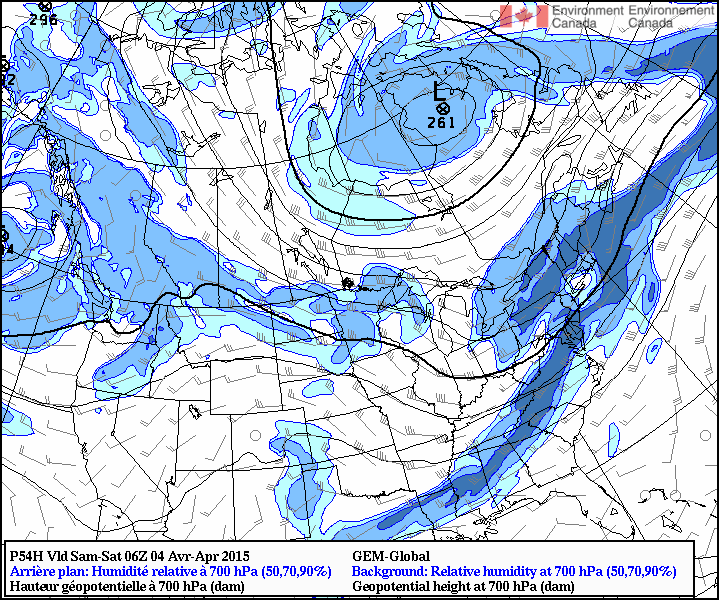
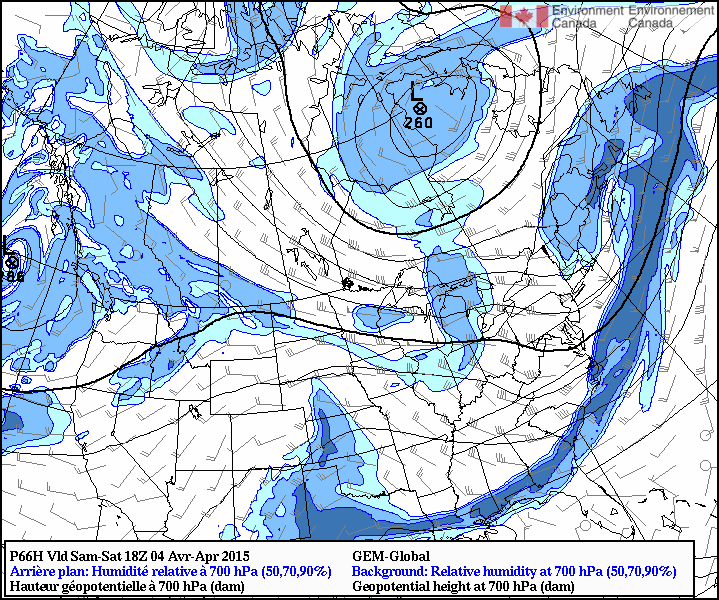
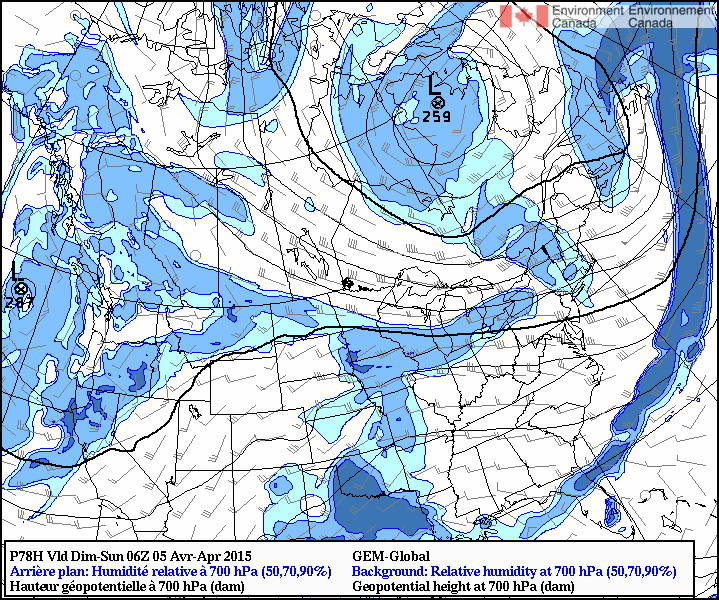
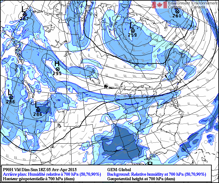
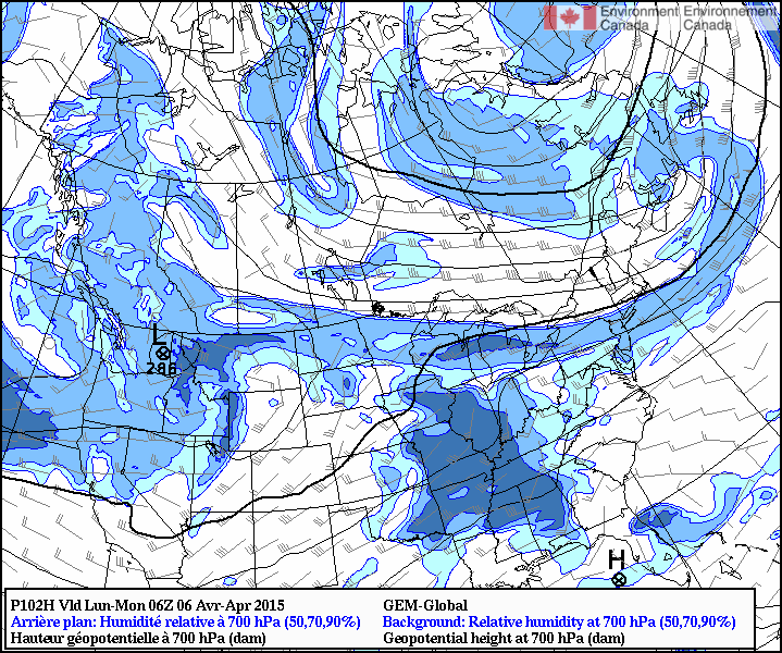
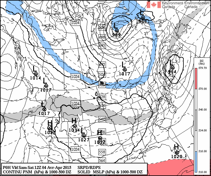
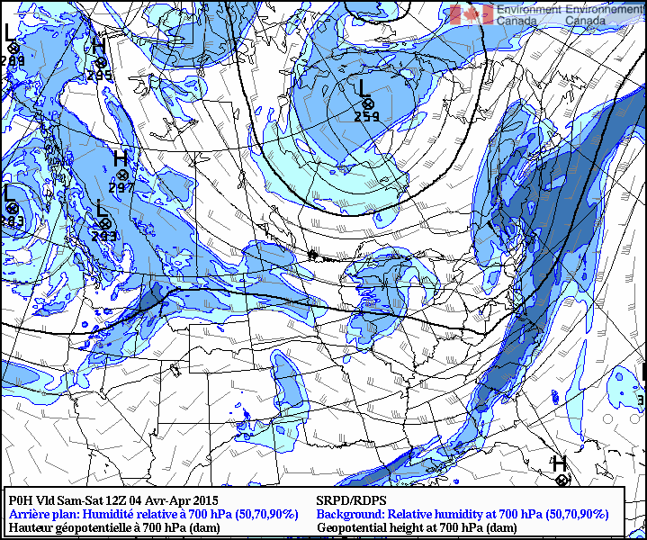
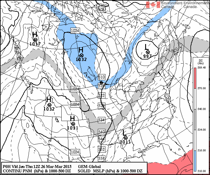
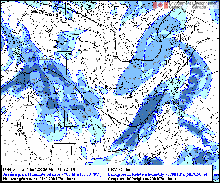
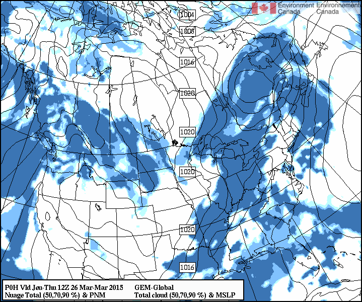
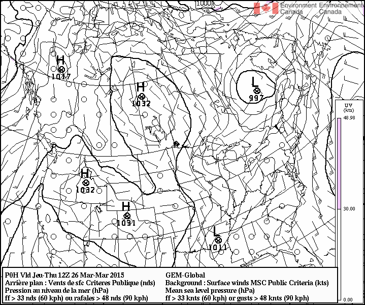
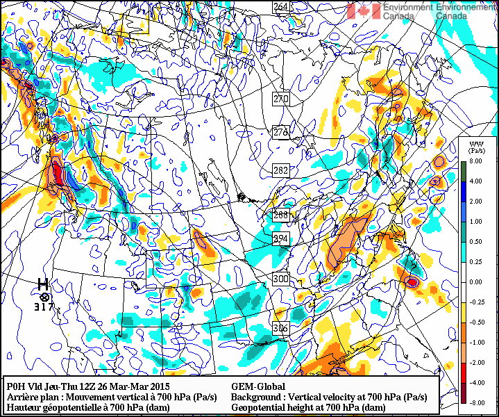
The GDPS run initialized at 12Z had not completed. From the GDPS prog initialized 00Z on Thurs. 2 April 2015:
Light to firm surface winds, dominantly easterly out of the arctic high -- whose axis runs roughly south-eastward from N. Saskatchewan through Manitoba. Neither a particularly cold nor a particularly warm scenario, in terms of thickness. No marked thickness advection. Surface temperature evolution will be a response to the cycle in surface energy balance, perhaps muted by cloud cover.
- 700 hPa at midnight Friday (54 h prog)
- 700 hPa at 12 MDT Saturday (66 h prog)
- 700 hPa at midnight Saturday (78 h prog)
- 700 hPa at 12 MDT Sunday (90 h prog)
- 700 hPa at midnight Sunday (102 h prog)
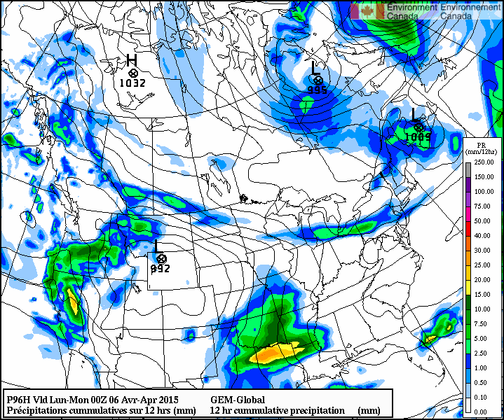
Humid, rather slack upper flow over the forecast region, which is outside the main upper stream; a southeasterly component.. thus conditions may tend to be rather unvarying. Liable to be cloudy.
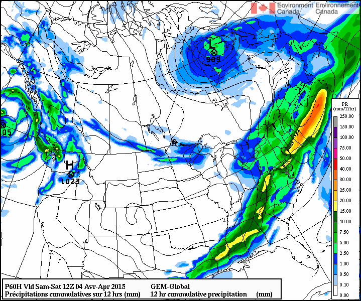
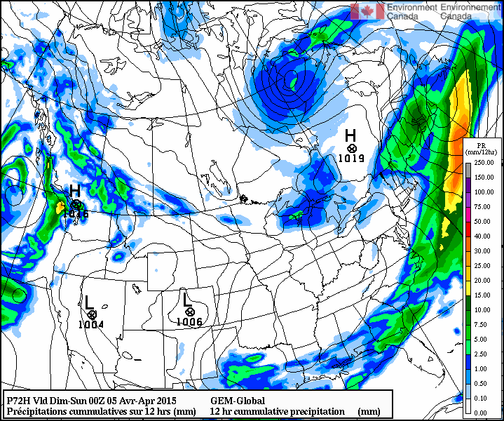
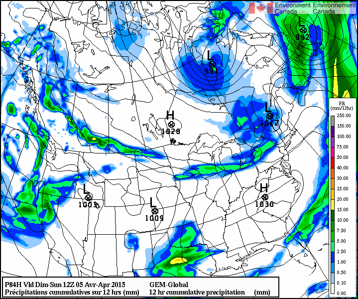
Precip will occur throughout the weekend, with some spatial vaiability across the forecast region. Precip type will be snow (not shown).
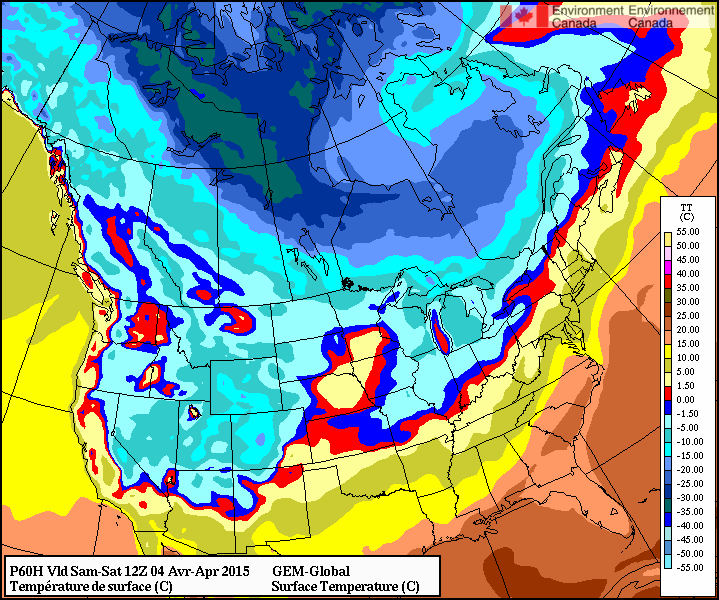
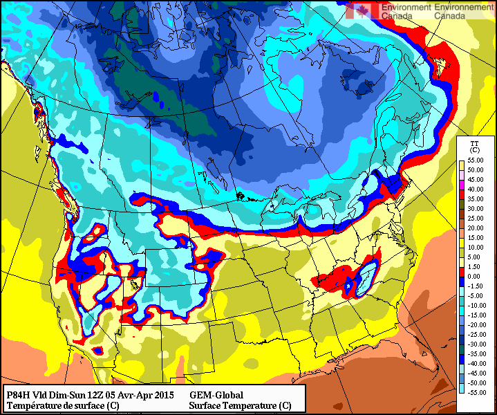
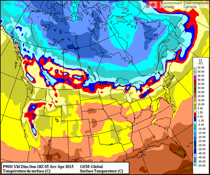
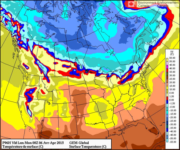
- Tsfc at 06 MDT Saturday (60 h prog)
- Tsfc at 12 MDT Saturday (66 h prog)
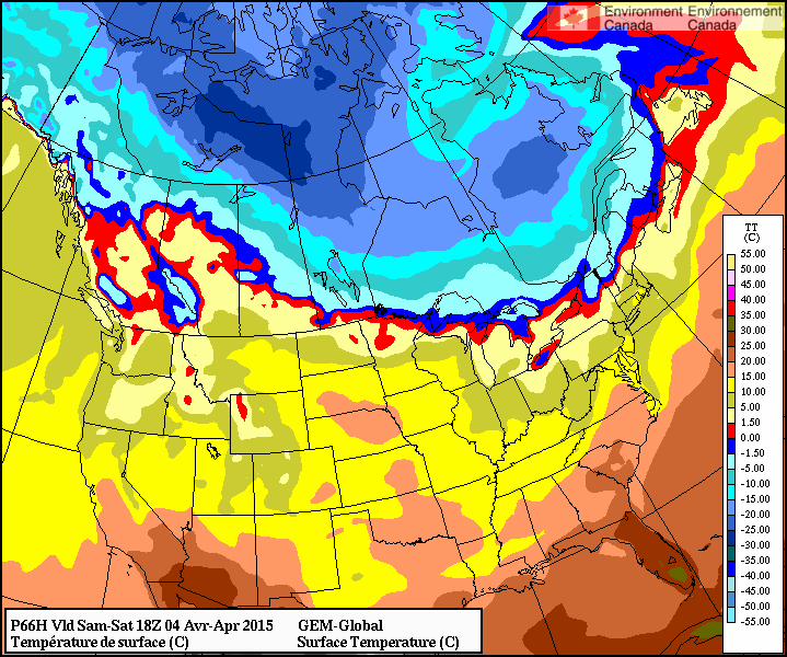
- Tsfc as of 18 MDT Saturday (72 h prog)
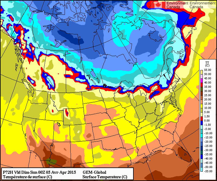
- Tsfc as of 06 MDT Sunday (84 h prog)
- Tsfc at 12 MDT Sunday (90 h prog)
- Tsfc as of 18 MDT Sunday (96 h prog)
Daytime thaws, implying the snow will be moist: blowing snow unlikely.
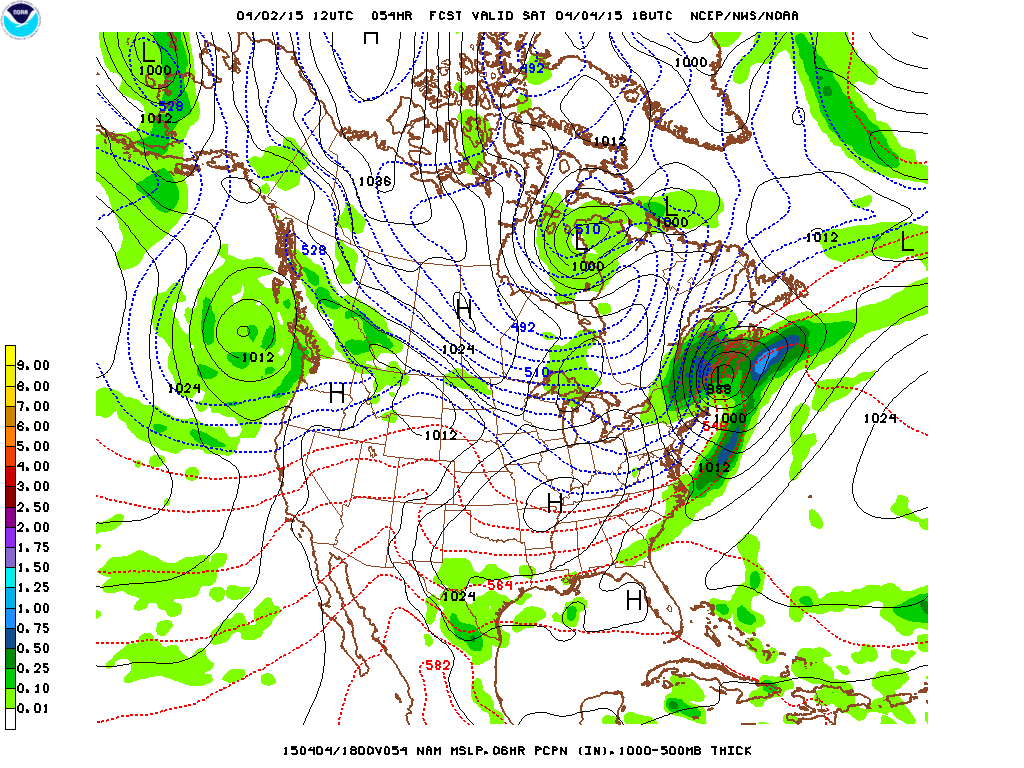
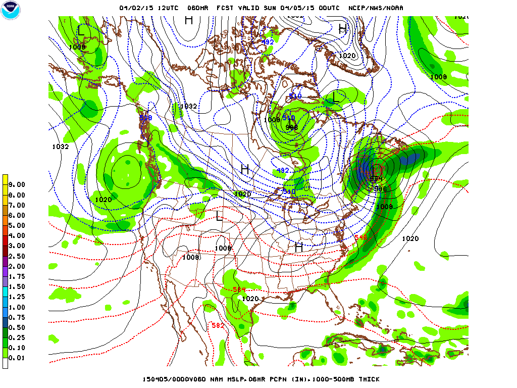
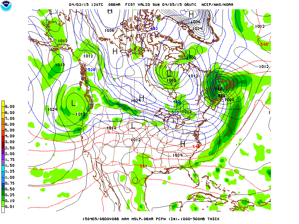
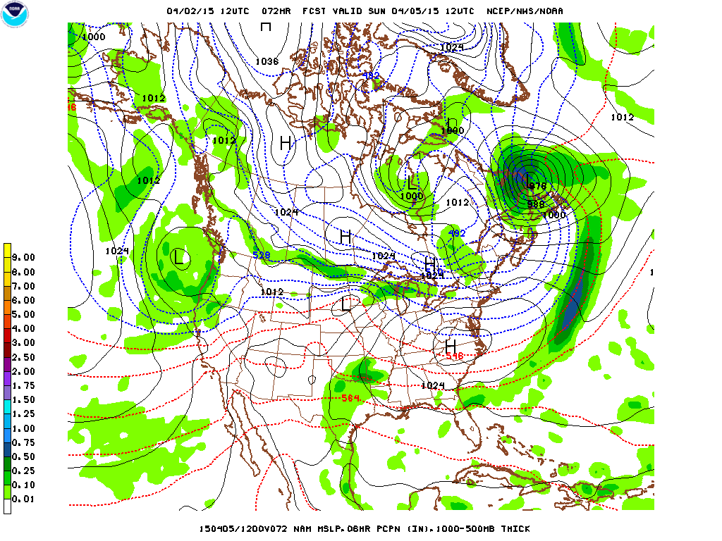
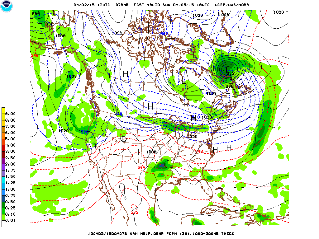
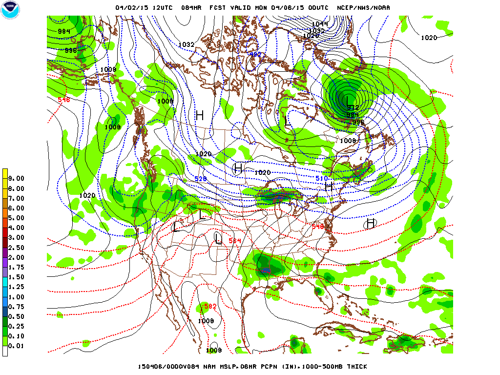
From NCEP's NAM forecast initialized 12Z April 2nd:
Confirms the general scenario of sustained, if spatially variable, precip; suggestion of stronger surface winds on Saturday than GEM?
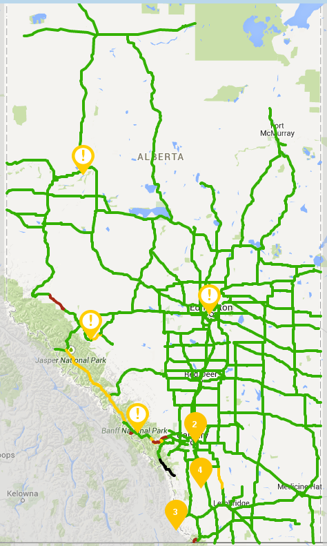
Conclusion: no serious problems for drivers, busy routes liable to remain clear; drifts may settle on quieter routes. Daytime thaws.
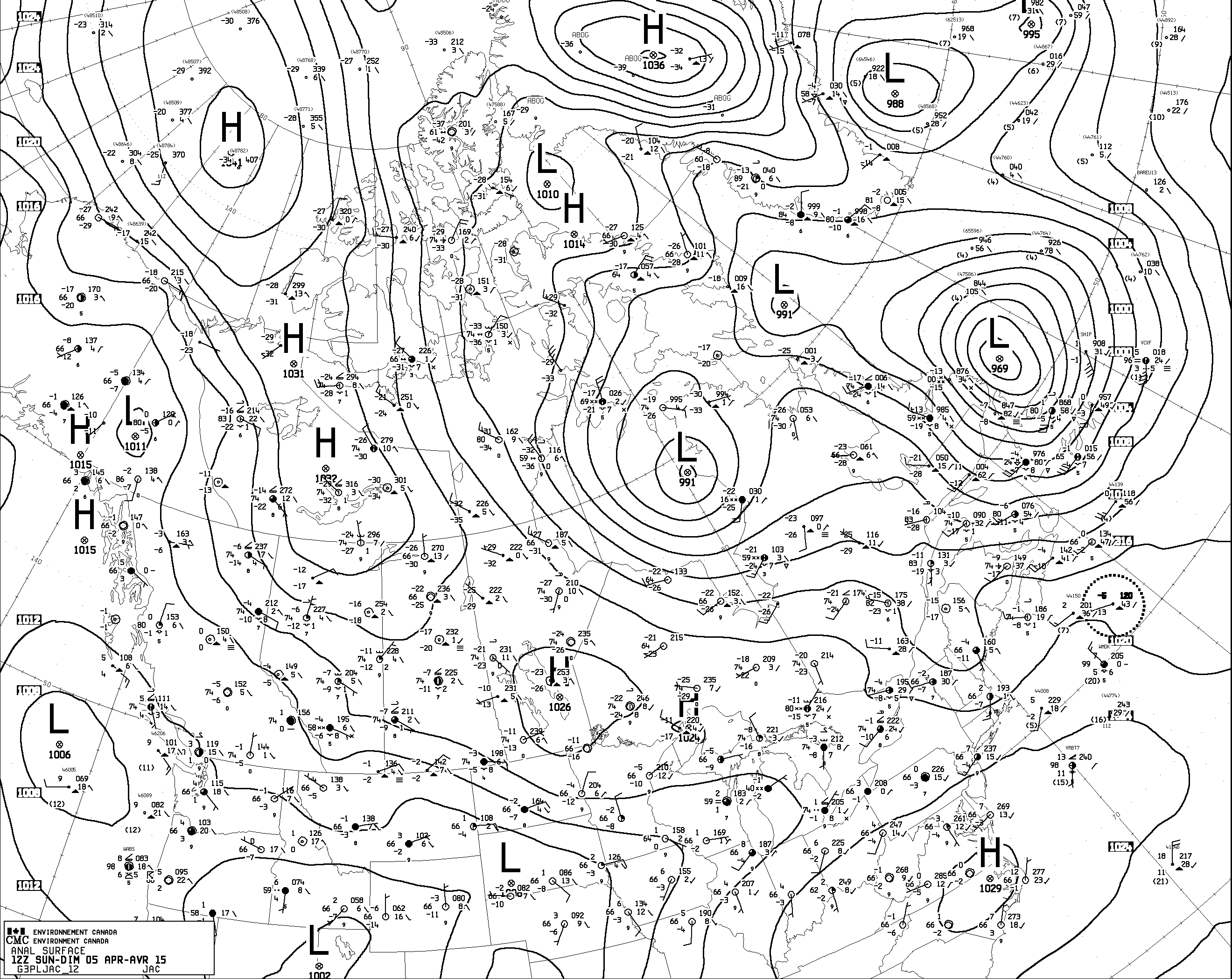
Verification data
Cloudy. Daytime thaws. Winds predominantly light, and easterly. Roads bare.
Example -- table comparing progs -- exercise of 31 March 2015
Forecasts for Lacombe Alberta, valid 18MDT 31 March 2015.
| Element | HRDPS West | RAP | NAM | Observed |
| Wind dir. | W (272) | W (274) | W (260) | NW |
| Wind speed | 18 kph | 12 kph | 26 kph | 16 kph |
| Surface temperature | 10oC | 12.8oC | 13.7oC | 11oC |
| Cloud fraction | 44% | 22% | 0% | overcast** |
**There was a frontal passage late afternoon (observed by JDW at Lacombe; also evidenced by Lacombe hourly data) with a rapid increase in wind speed and an abrupt fall in temperature. The peak gust speed for Lacombe was 69 kph. Model-to-model differences in the forecast timing of the frontal passage likely explain the differing forecast details (unfortunately JW did ot archive the actual meteograms, which would have illustrated the frontal passage).
Verification data for present weather summary (C. Alberta, 12Z Thurs 26 March 2015
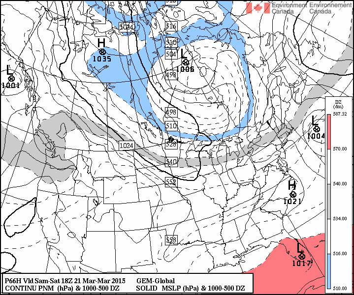
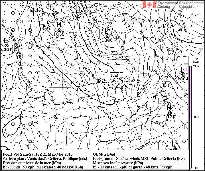
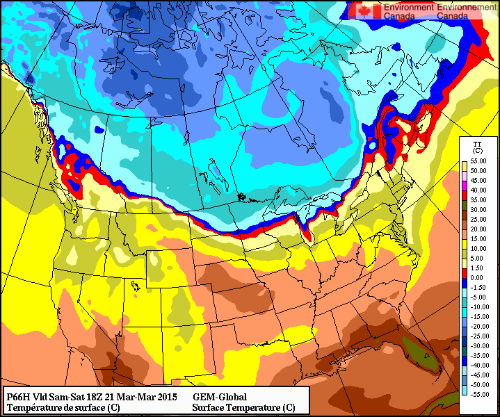
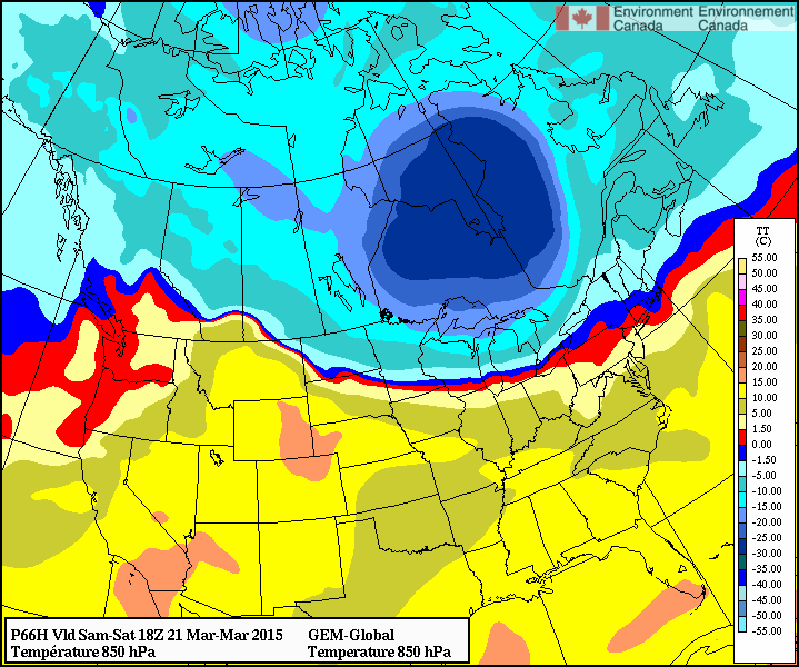
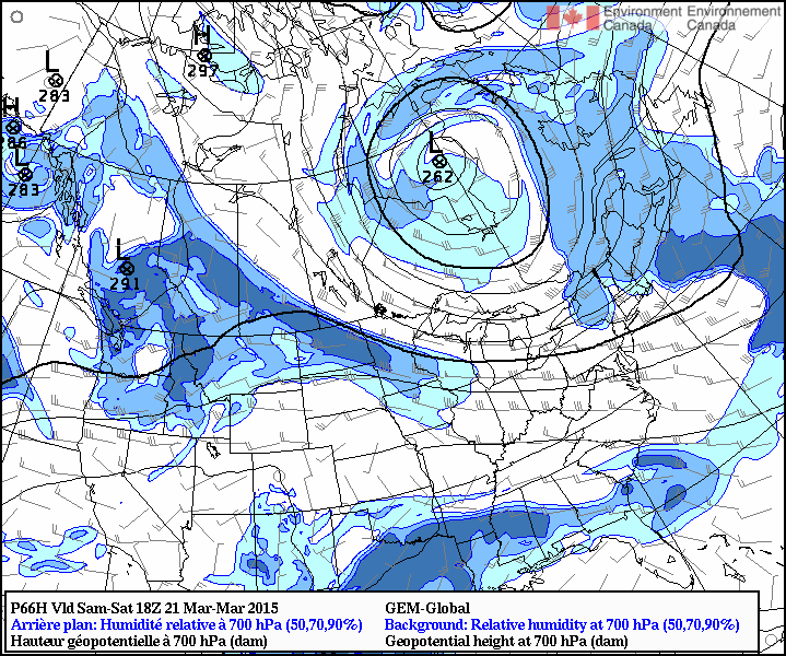
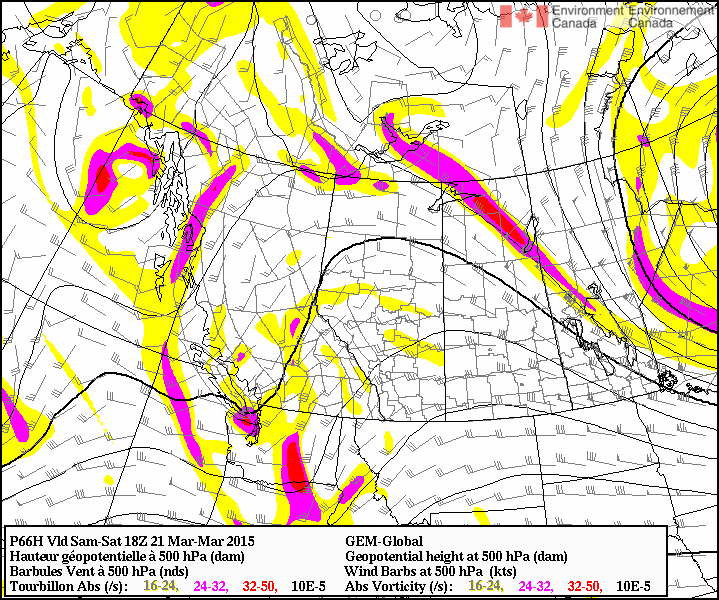
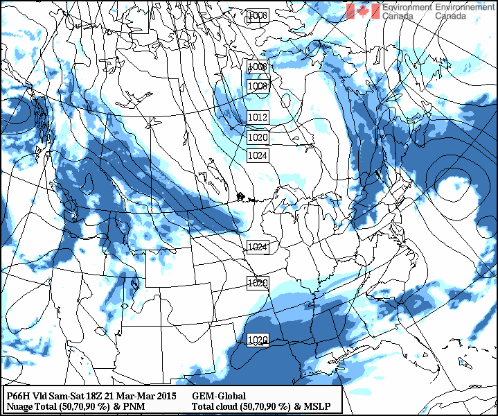
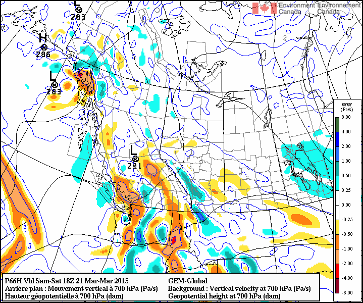
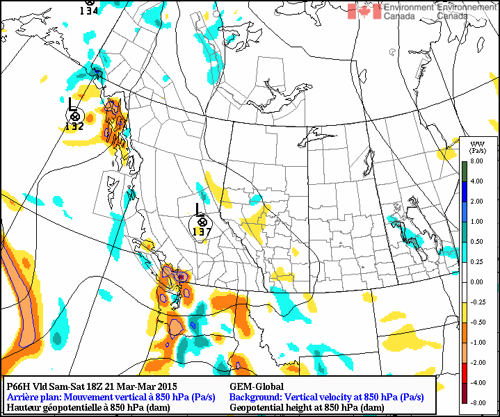
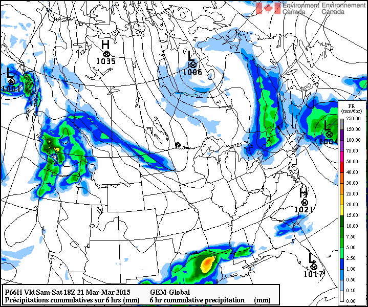
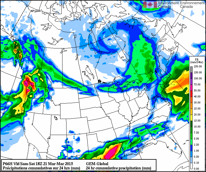
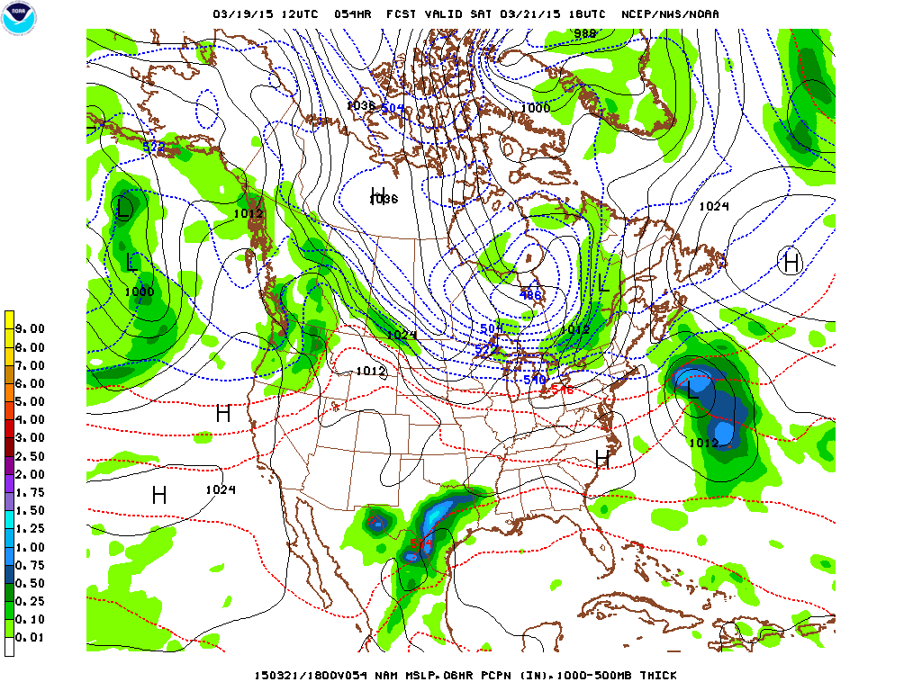
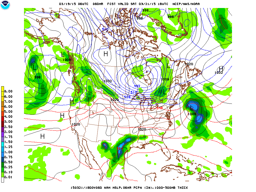
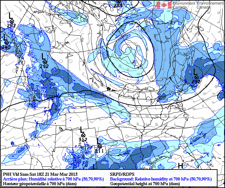
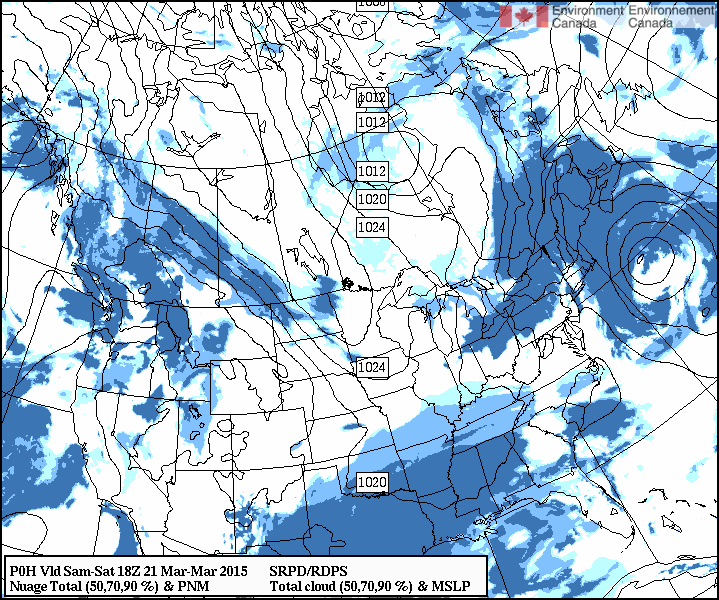
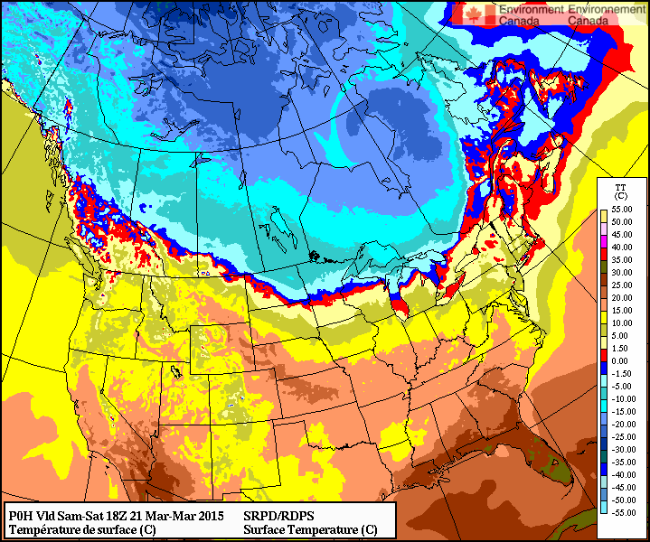
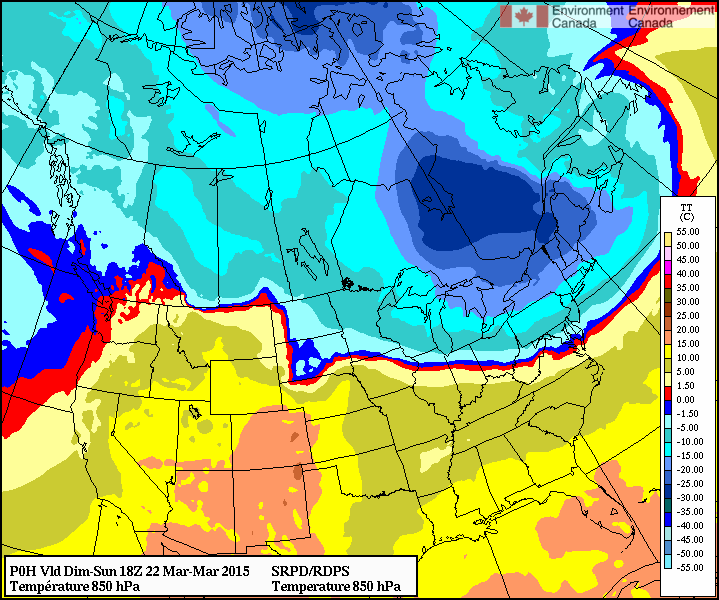
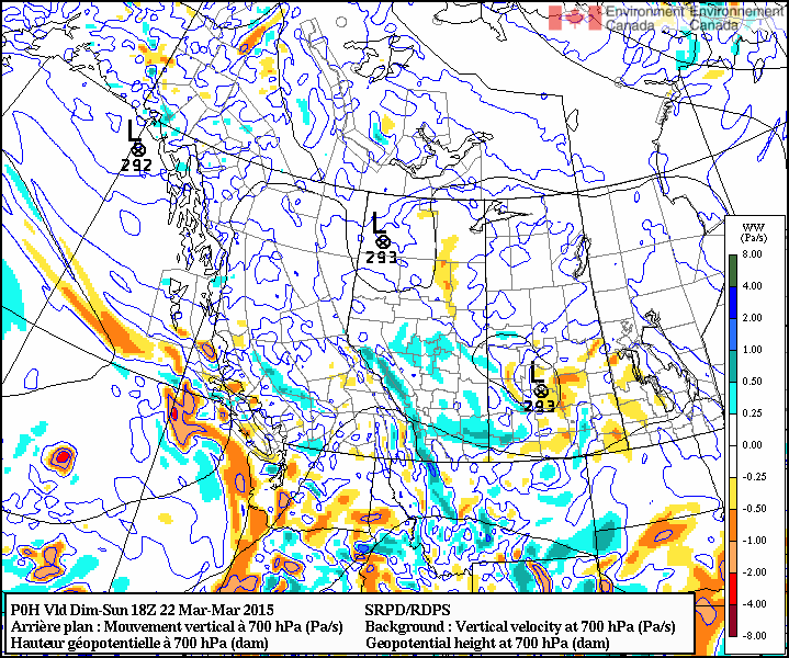
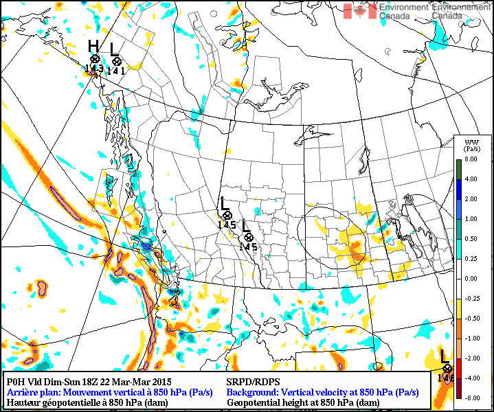
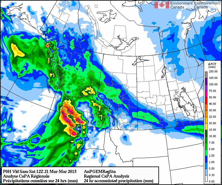
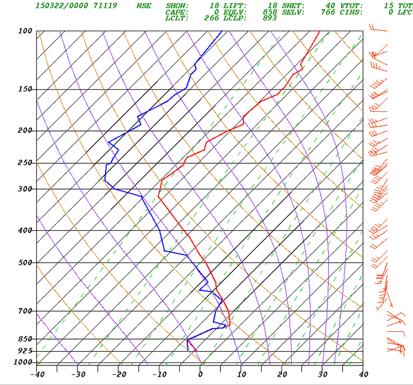
Available data for forecasts prepared Thurs 19 Mar. and valid 18Z 21 Mar. 2015
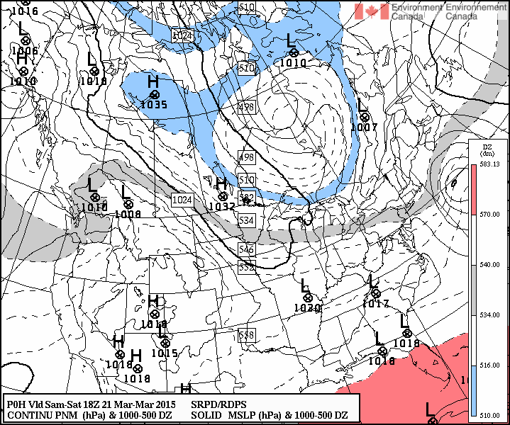
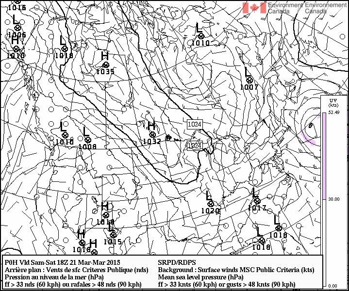
The RDPS run initialized at 12Z had not completed. From the 66h GDPS prog initialized 00Z on Thurs. 19 Mar. 2015:
From NCEP:
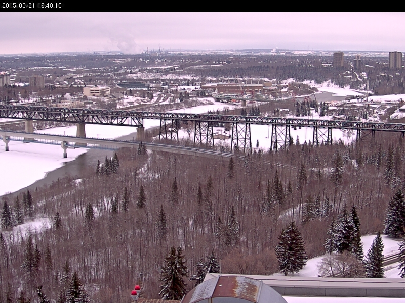
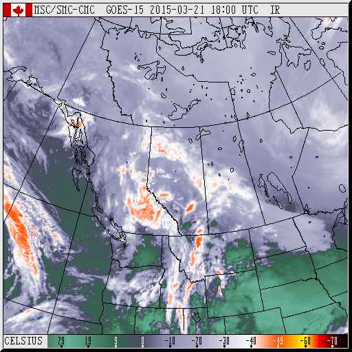
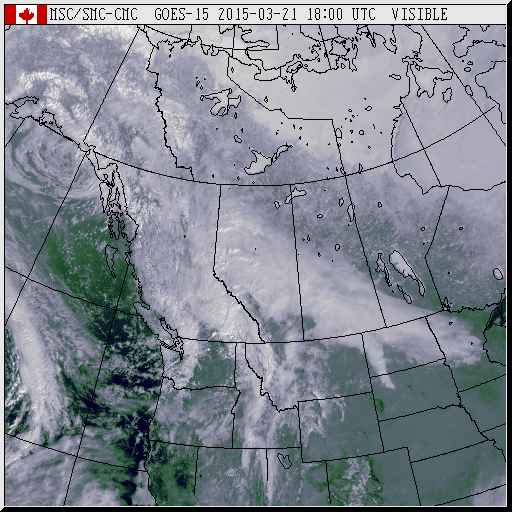
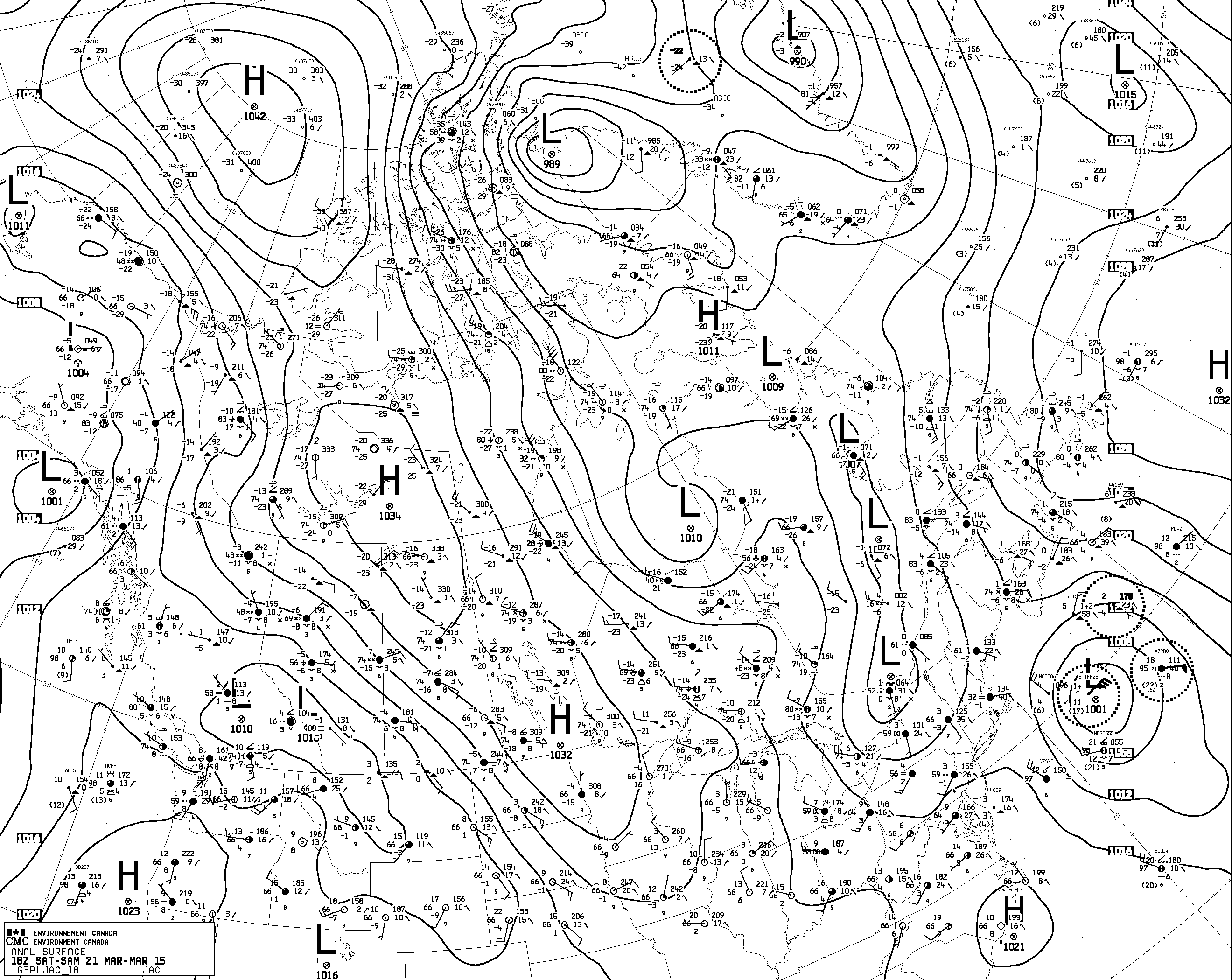
Verification data valid at (or near) 18Z Saturday 21 March 2015:
- Tory webcam 17 MST
- Goes ir, Goes vis at 18Z
- CYEG 211800Z 09017KT 15SM OVC013 M04/M07 A2992 RMK SC8 SLP170=
- Hourly weather conditions at YEG (International Airport)
- Hourly weather conditions at Edmonton (City Centre Airport)
- Surface analysis
- MSC forecasters' discussion 0700 CST and 1400 CST
- RDPS 0h prog valid 18Z
- Summary: Firm (circa 20 kph or stronger) surface easterly (upslope) out of artic ridge (ridge axis through Saskatchewan). Overcast (SCu). Not very cold (minus 5). Recent snow. Southerly aloft, and humid, but no strong vertical motion. Sounding quite stable, surface easterly beneath upper humid southerly.
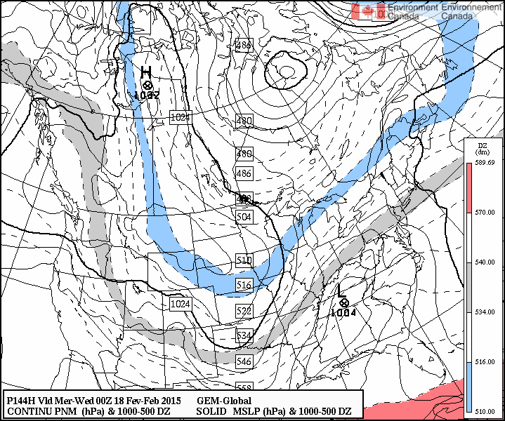
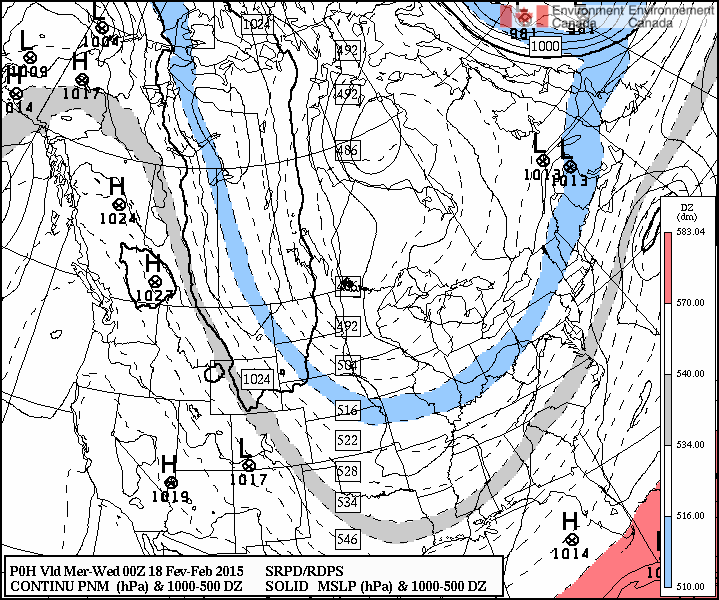
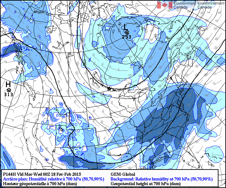
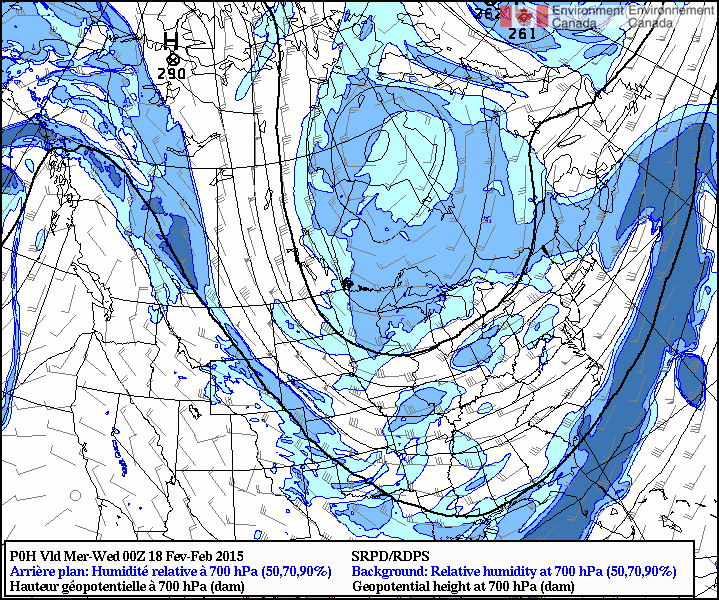
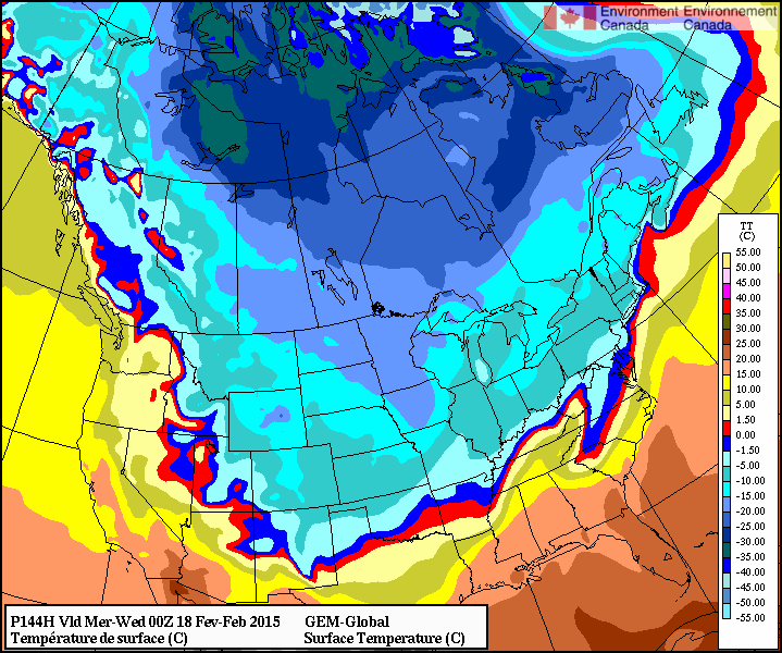
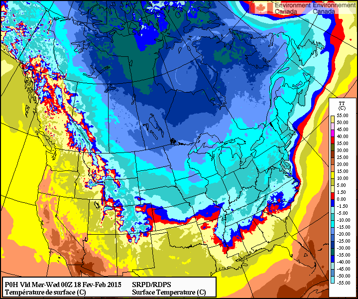
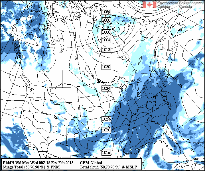
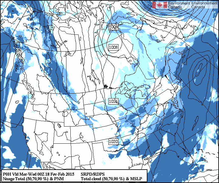
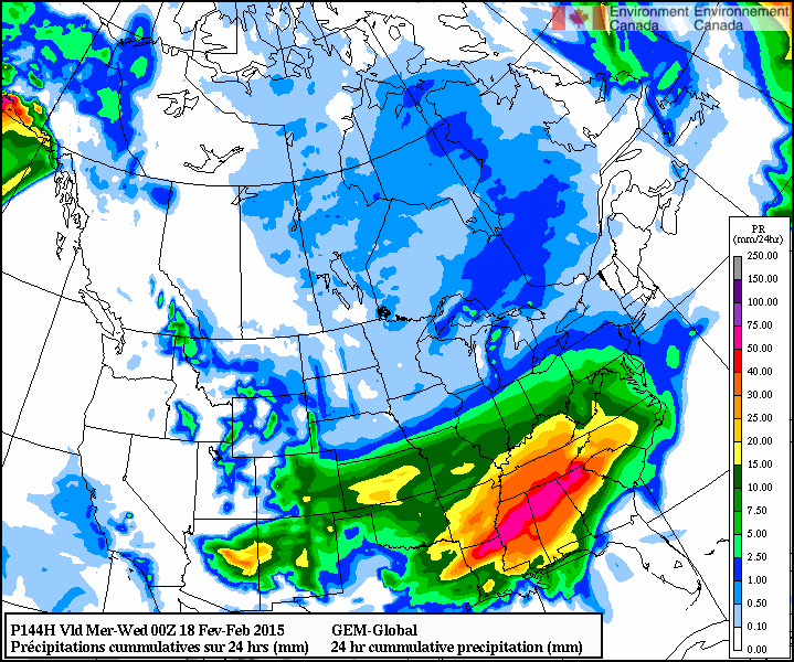
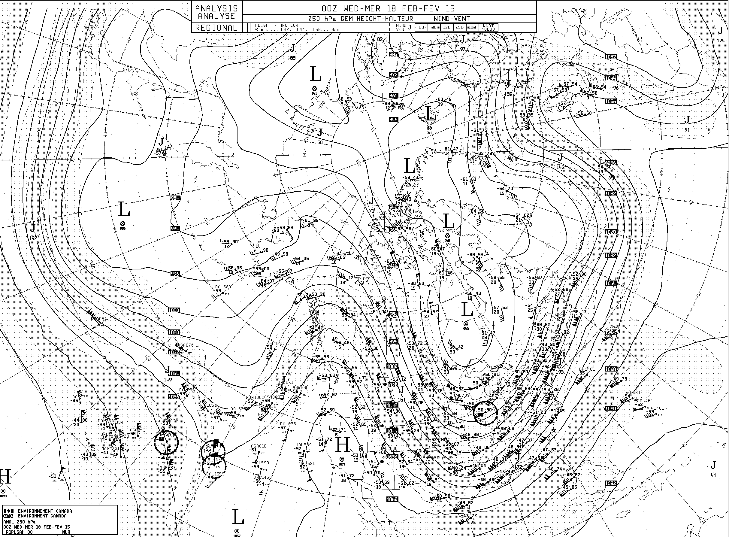
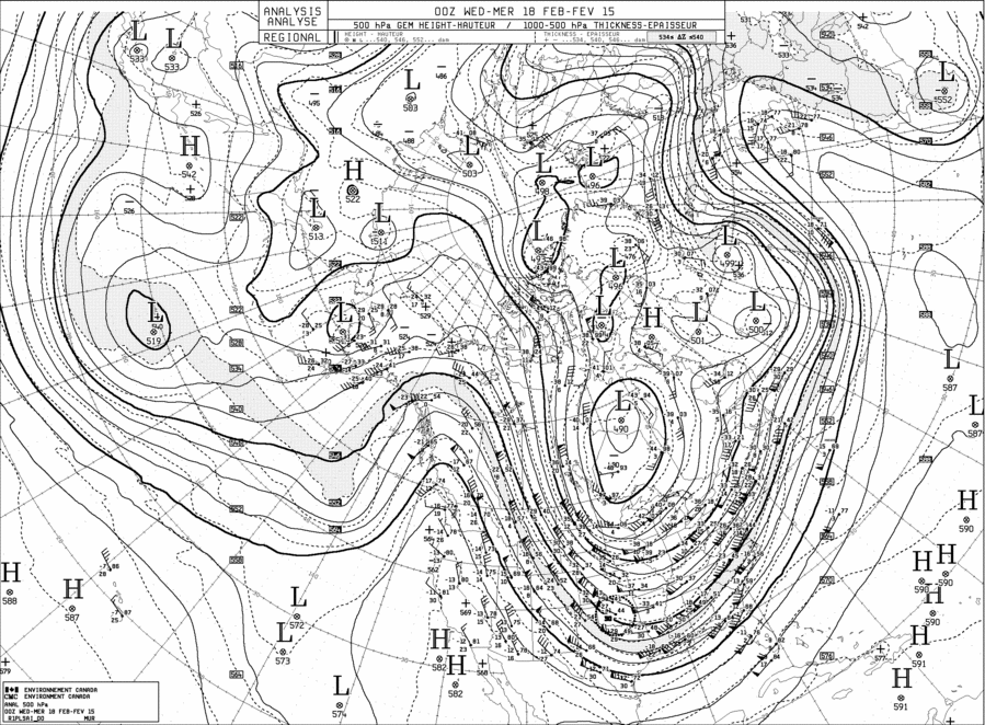
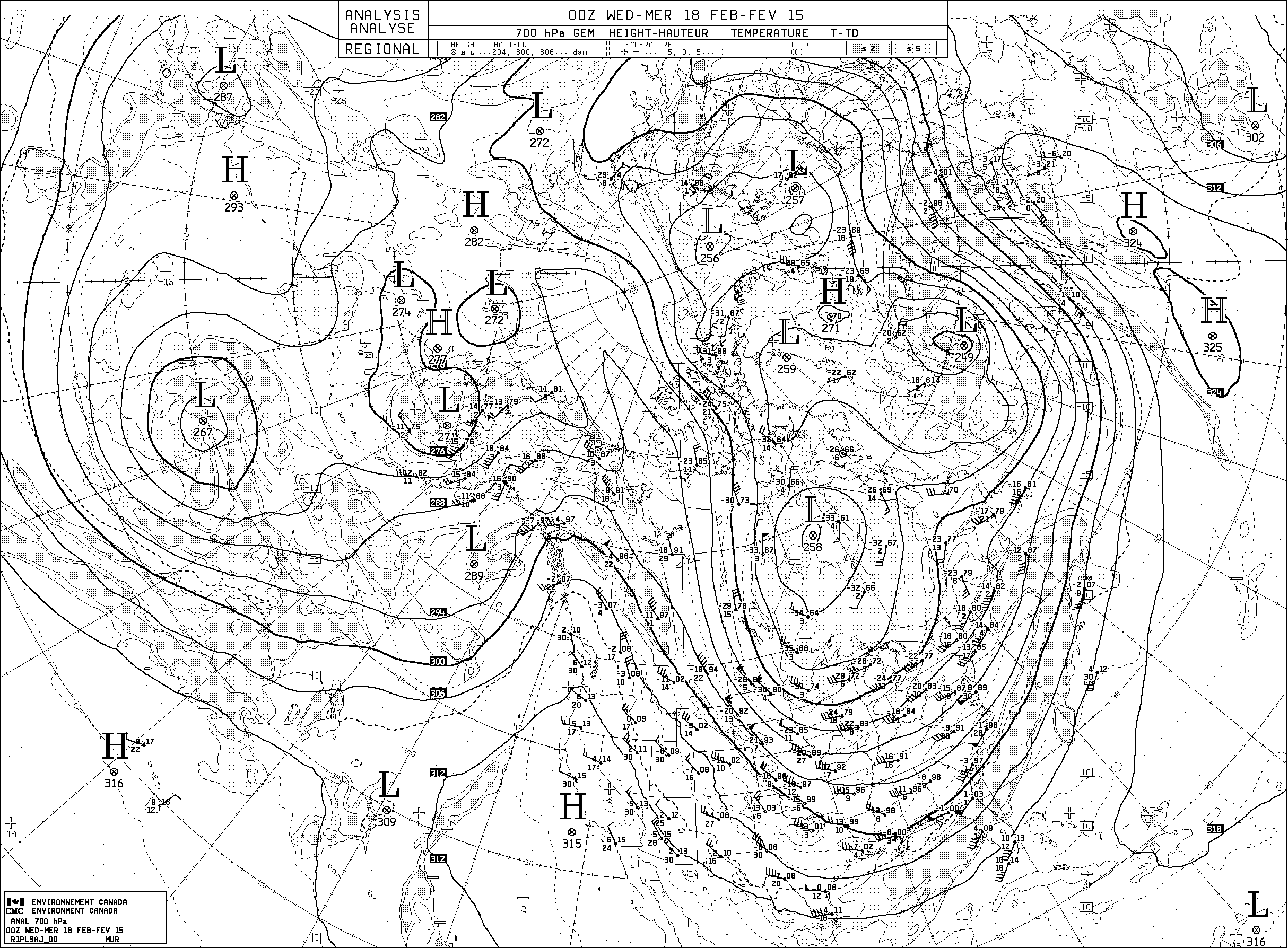
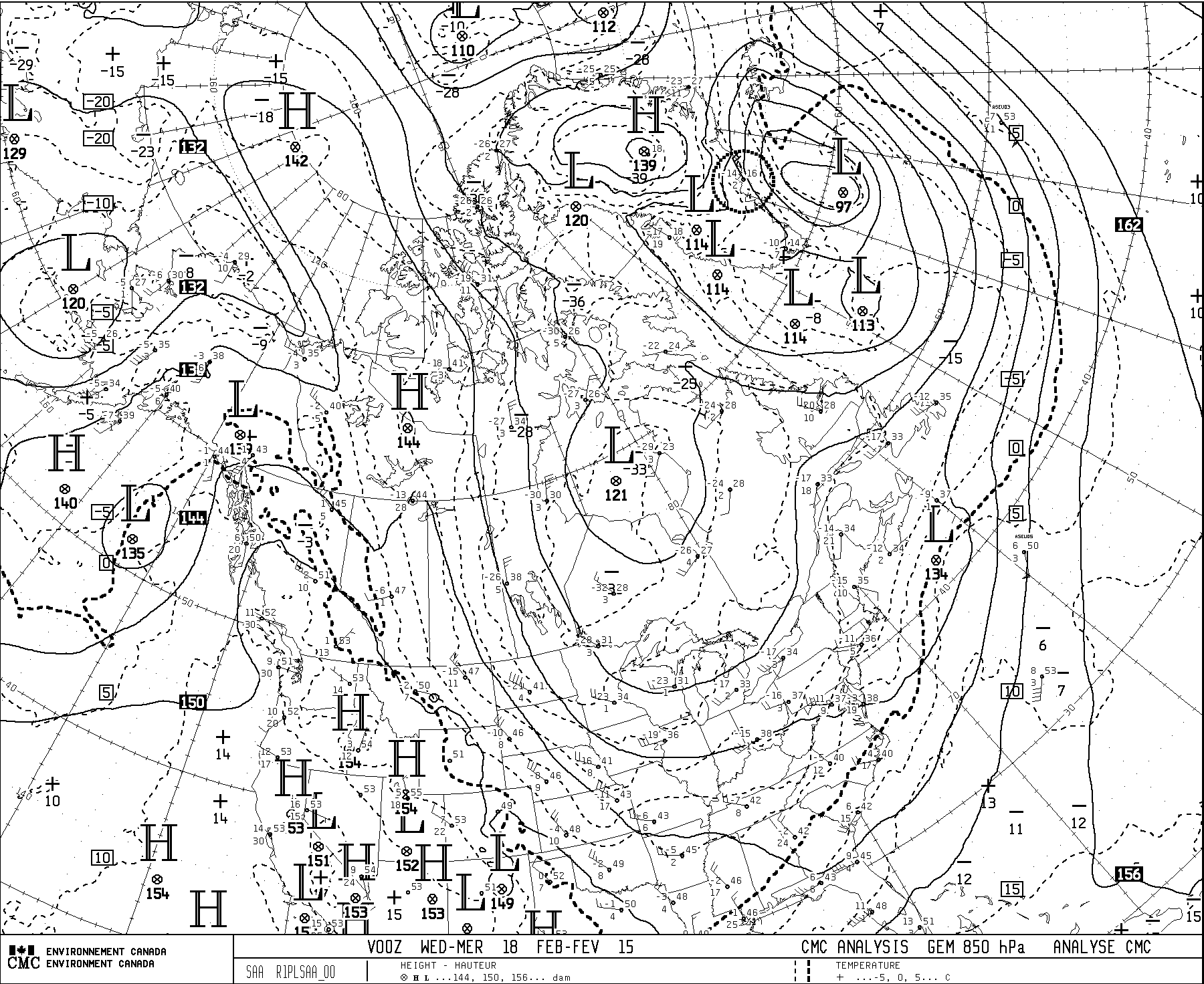
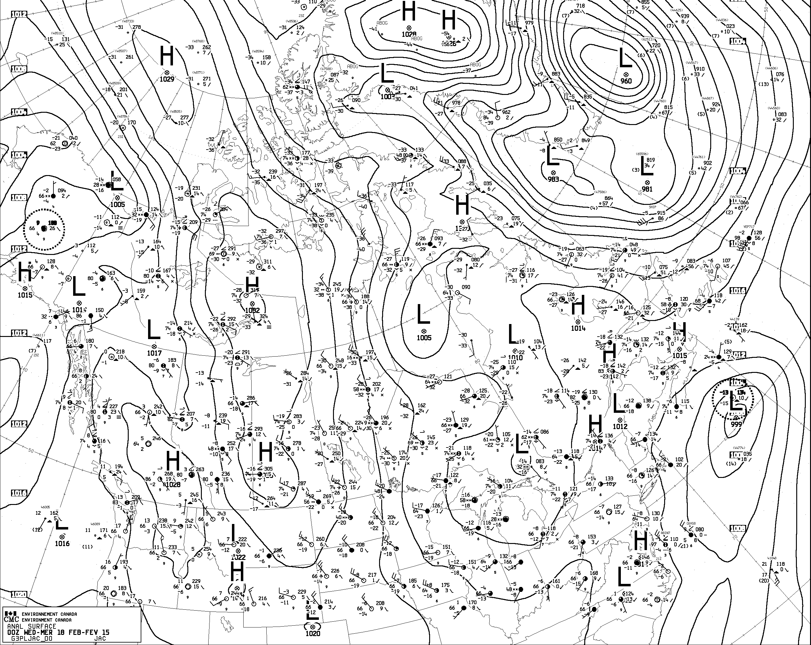
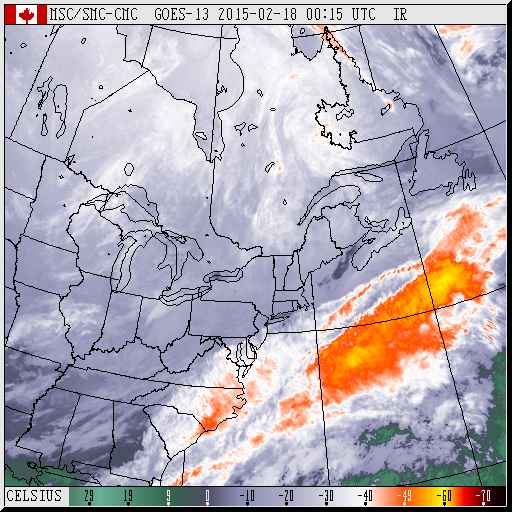
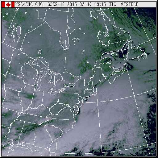
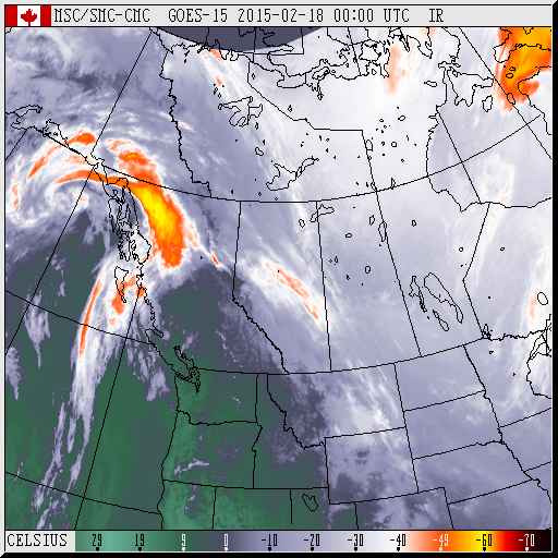
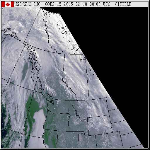
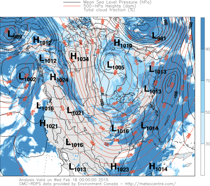
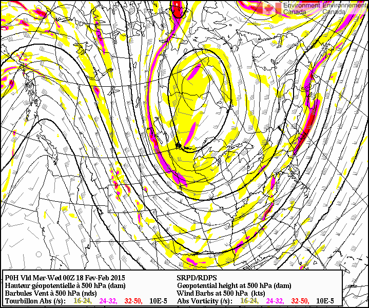
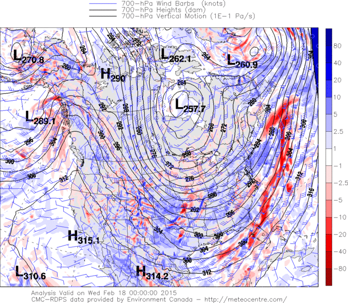
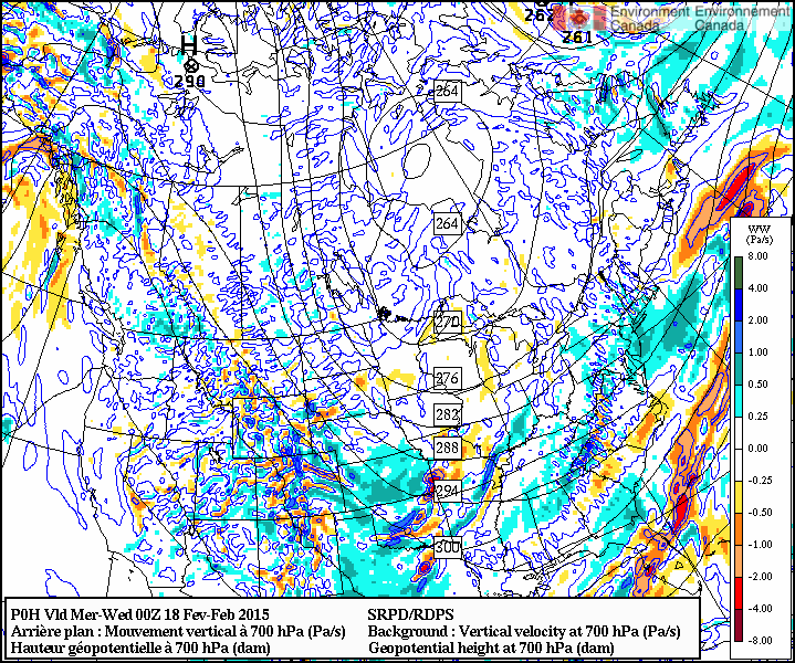
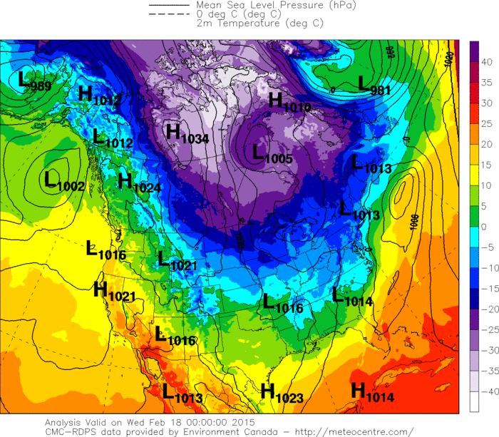
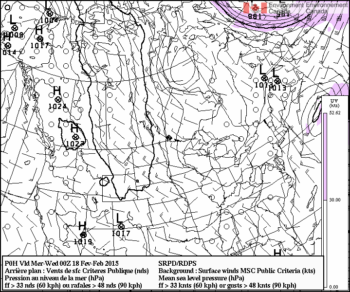
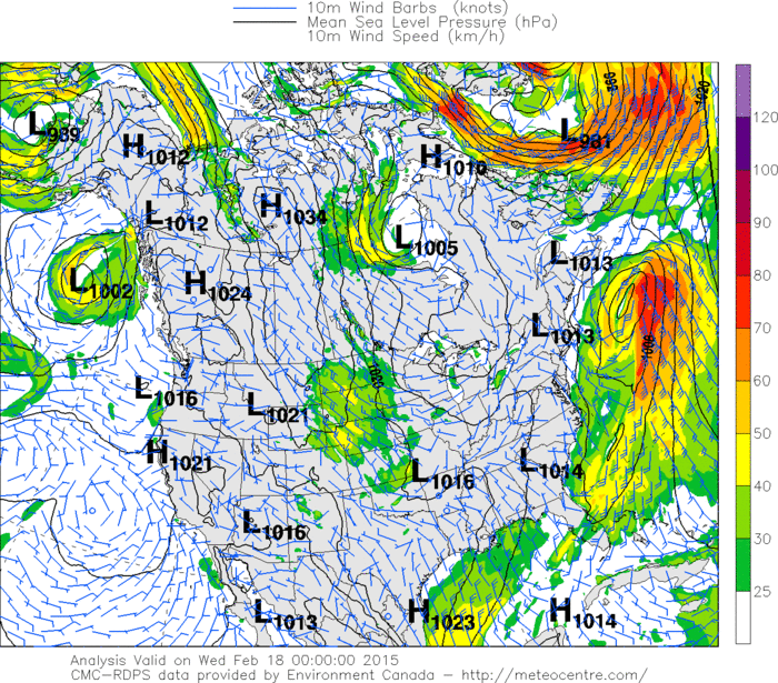
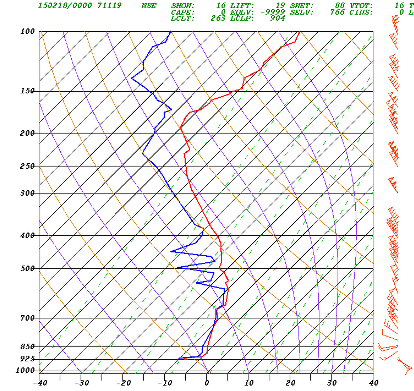
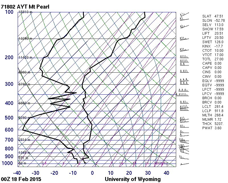
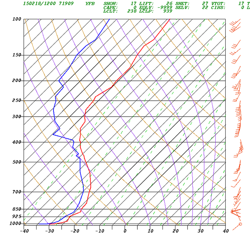
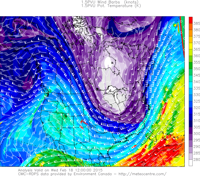
Available data for forecasts prepared Thurs 11 Feb. and valid 00Z 18 Feb. 2015
From the GDPS 144h prog valid 00Z on Wed. 18 Feb. 2015:
Snapshot of conditions at 00Z Wednesday 18 Feb.:
Back to the EAS 372 home page.
Link to Earth & Atmospheric Sciences home page.
Last Modified: 6 Apr., 2015