| Activity/Topic | |
|---|
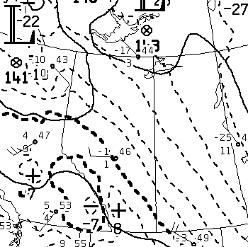
| Prepare a short range (e.g. 48-hr) weather forecast based on NWP guidance (repeating exercise) | ✔ |
| Prepare a short range (e.g. 48-hr) weather forecast without NWP guidance | |
| Calculations using hydrostatic law, ideal gas law, sat.vap. press. tables | ✔ |
| Compute geostrophic wind from height contour spacing | ✔ |
| Compute rate of temperature advection | ✔ |
| Plot a sounding | ✔ |
| Use the skew-T chart to compute various properties (LCL, LFC, potential temperatures etc.) | ✔ |
| Plot time series of thickness alongside time series of layer-mean temperature | assig. 1 |
| Plot hodograph; add wind vectors V1, V2 and thermal wind VT21=V2-V1; infer (probable) location of colder air | ✔ |
| Deduce GOES ir cloud top height from ir target T, using sounding | ✔ |
| Plot a cross-section from radiosonde data at stations along a transect | |
| Plot differential met. fields (e.g. moisture convergence) from archived (recent or historic) data | ✔ |
| Analyses and forecasts of vertical motion available from NWP models | ✔ |
| Compare NWP fields for vorticity advection, horiz. divergence, thermal advection & vertical motion (context: QG paradigm) | ✔ |
| Examples of frontogenesis in relation to deformation | ✔ |
| Compute crop evapotranspiration (vertical eddy flux of water vapour) from time series of velocity and humidity | assig. 3 |
| Plot diurnal cycle of components of the surface energy budget | ✔ |
| Change in heat storage inferred from subsequent soundings. Implied 12-hr mean surface heat flux | ✔ |
| Generate weather chart(s) for a past day from web-accessible archive (reanalysis) | ✔ |
| Generate chart giving climatological contours (e.g. isobaric height, or thickness) from web-accessible archive | |
| Online computation/display of air parcel back-trajectories based on NWP wind fields | ✔ |
| Compute a histogram and probability density function from given data | |
Calculating Heidke skill score | |
| Student weather briefings | ✔ |
| Theme | Activity/Topic |
|---|
| Vocabulary & meaning of equations | Transport equations: derive statements of conservation of heat and of mass in Cartesian coordinates ✔ Express these in vector notation ✔ Unit vectors ✔ Grad operator ✔ Laplacian operator ✔ Fourier's law and Fick's law ✔ Heat equation✔ Diffusion equation✔ | ✔ |
| Lagrangian derivative✔ Conserved variables ✔ Conservation of thermodynamic energy ✔ Velocity divergence ✔ | ✔ |
| The equations of motion in vector form ✔ and in component form relative to local rotating Cartesian coordinates ✔ | ✔ |
| Atmospheric Paradigms | Geostrophic wind model✔ | ✔ |
| Continuity equation in isobaric coordinates✔ Height-integrated continuity equation✔ Relationship between horizontal divergence and vertical motion✔ Level(s) of non-divergence✔ | ✔ |
| Thermal wind✔ | ✔ |
| The quasi-geostrophic model✔ Vorticity equation✔ Height tendency equation. Omega equation✔ Q-vector✔ Significance of vorticity advection and thermal advection✔ | ✔ |
| Isentropic potential vorticity and the "dynamic troposphere" | |
| Everyday tools | Thermodynamic chart✔ Hodograph✔ | ✔ |
| Hypsometric equation✔ Dry adiabatic lapse rate✔ Natural coordinate system✔ | ✔ |
| Potential temperature✔ Thermodynamic chart✔ Energetics of vertical motion✔ | ✔ |
| Water vapour calculations✔ Dewpoint lapse rate✔ Mixing ratio lines on the thermodynamic chart✔ | ✔ |
| METARs✔ meteograms✔ TAF, PIREP, Graphical Area Forecast (GFA) | ✔ |
| Vertical motion on the synoptic scale✔ Relationship with precipitation✔ Precipitable water✔ Vertical flux of water vapour✔ | ✔ |
| Further differential properties of the wind field: deformation✔ | ✔ |
| Satellite data | GOES, POES and exotic meteorological satellites | ✔ |
| Unresolved motion & ABL | Decomposition into resolved/unresolved scales of motion✔ Fundamental view of friction✔ The closure problem✔ Eddy diffusion parameterization✔ | ✔ |
| Heat, mass and momentum exchange between the surface and the free troposphere. Unresolved ("turbulent") vertical fluxes in the atmospheric boundary layer✔ | ✔ |
| The surface layer ("constant flux layer")✔ Elements of Monin-Obukhov theory✔ The surface energy balance✔ | ✔ |
| Heat budget of the horizontally-uniform atmospheric boundary layer✔ | ✔ |
| Fronts & frontogenesis | ✔ |
| NWP | MSC's Global Environmental Multiscale model - model dynamics | ✔ |
| MSC's GEM model - parameterizations | ✔ |
| NCEP's short range NAM/WRF model | |
| NCEP's long range GFS (Global Spectral) model | |
| Reanalyses✔ reforecasts, downscaling | |
